Category:1794 maps of Africa
Jump to navigation
Jump to search
Temperate regions: North America · South America · Africa · Europe · Asia · – Polar regions: – Other regions:
| ← 1790 1791 1792 1793 1794 1795 1796 1797 1798 1799 → |
Media in category "1794 maps of Africa"
The following 22 files are in this category, out of 22 total.
-
A general atlas Fleuron T221425-9.png 926 × 797; 45 KB
-
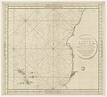
A survey of the entrance of Sierra Leona river - Capt. Thomson - btv1b53153533j.jpg 4,468 × 5,676; 2.89 MB
-
Africa - DPLA - 588ebfea53bfb0dd83dba27383e9eeba.jpg 1,000 × 756; 306 KB
-
Africa nach Robert Vaugondy, Rennells und Sotzmanns Skizze... - btv1b8469053n.jpg 10,018 × 8,922; 13.42 MB
-
La Guinea occidentale (Antonio Zatta 1794, twelve small maps).jpg 374 × 569; 75 KB
-
La Guinea orientale (Antonio Zatta 1794, twelve small maps).jpg 378 × 559; 80 KB
-
Life-expectancy,Africa,1794.svg 850 × 691; 12 KB
-
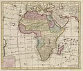
Nieuwe Kaart van Africa - DPLA - 71aafdbbb80a41f3b2d094c792ffeae7.jpg 1,000 × 858; 286 KB


