Category:1774 maps of North America
Jump to navigation
Jump to search
Subcategories
This category has only the following subcategory.
U
Media in category "1774 maps of North America"
The following 17 files are in this category, out of 17 total.
-
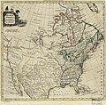
A map of the British Empire in North America. LOC 74694152.jpg 4,213 × 6,250; 3.87 MB
-
A map of the British Empire in North America. LOC 74694152.tif 4,213 × 6,250; 75.33 MB
-
Amérique du Nord-Est,Raynal.-Histoire des deux Indes,1774.png 500 × 680; 311 KB
-
Geography 013 - The 13 Original Colonies of the United States.jpg 1,657 × 1,197; 465 KB
-
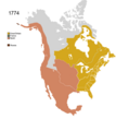
Non-Native Nations Claim over NAFTA countries 1774.png 800 × 895; 141 KB
-
North America (4071881367).jpg 2,000 × 1,644; 3.34 MB
-
North America (9471676269).jpg 800 × 655; 129 KB
-
North America as divided amongst the European powers (12326150153).jpg 2,500 × 1,806; 1.51 MB
-
North America, as divided amongst the European powers. LOC 74694267.jpg 5,419 × 3,815; 3.39 MB
-
North America, as divided amongst the European powers. LOC 74694267.tif 5,419 × 3,815; 59.15 MB
-
North America. LOC 75693208.jpg 4,343 × 4,270; 2.9 MB
-
North America. LOC 75693208.tif 4,343 × 4,270; 53.06 MB
-
North America, as divided amongst the European powers (NYPL b15398598-434859).jpg 5,883 × 4,400; 4.75 MB


