Category:1772 maps
Jump to navigation
Jump to search
| ← · 1770 · 1771 · 1772 · 1773 · 1774 · 1775 · 1776 · 1777 · 1778 · 1779 · → |
Deutsch: Karten mit Bezug zum Jahr 1772
English: Maps related to the year 1772
Español: Mapas relativos al año 1772
Français : Cartes concernant l’an 1772
Русский: Карты 1772 года
Subcategories
This category has the following 6 subcategories, out of 6 total.
Media in category "1772 maps"
The following 65 files are in this category, out of 65 total.
-
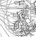
Rockall Kerguelen map 1771.jpg 813 × 838; 158 KB
-
A plan of the township of Blenheim, as surveyed and divided in the year 1772. LOC 74692222.jpg 15,168 × 12,553; 22.58 MB
-
A plan of the township of Blenheim, as surveyed and divided in the year 1772. LOC 74692222.tif 15,168 × 12,553; 544.75 MB
-
Anthony Cardon, Icon Sinus Baiarum Uti Nuper Videbatur (FL159288477 2591347).jpg 17,206 × 12,014; 255.25 MB
-
Czaczersk.starostwo-1772.jpg 798 × 606; 79 KB
-
Didier Robert de Vaugondy, Carte des parties nord et est de l'Asie (FL147398644 2608056).jpg 9,737 × 8,022; 84.15 MB
-
EasterIsland 1772.JPG 3,750 × 5,308; 2.53 MB
-
Giuseppe Bracci, Icon Sinus Baiarum Uti Nunc Videtur (FL159288483 2591352).jpg 17,444 × 12,665; 266.85 MB
-
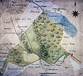
Hagen Haus Dahl Karte 2.jpg 3,909 × 2,745; 3.79 MB
-
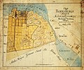
Hornsberg 1772.jpg 2,444 × 2,044; 1.19 MB
-
Jassaud map kerguelen expedition 1771 1772.JPG 5,607 × 7,344; 3.31 MB
-
Jean Baptiste Bourguignon d'Anville, Asia according to the Sieur d'Anville 01 (FL27959756 2487118).jpg 28,823 × 12,576; 502.51 MB
-
Jean Baptiste Bourguignon d'Anville, Asia according to the Sieur d'Anville 02 (FL27959762 2487118).jpg 28,897 × 12,766; 505.78 MB
-
Jean Delagrive, Nouvelle Carte de la Terre Sainte 01-north (FL13736241 2368514).jpg 7,496 × 5,512; 67.12 MB
-
Jean Delagrive, Nouvelle Carte de la Terre Sainte 02-south (FL13736242 2368514).jpg 2,800 × 2,157; 3.32 MB
-
Joseph-Romain Joly, Carte des villes épiscopales de la Palestine (FL45582553 3922551).jpg 2,798 × 4,105; 2.61 MB
-
Joseph-Romain Joly, Carte des voyages d'Abraham et des Patriarch.ES (FL45582557 3922527).jpg 4,613 × 3,128; 3.52 MB
-
Mappa da barra de Macao LOC 89696137.jpg 4,889 × 8,400; 5.06 MB
-
Mappa da barra de Macao LOC 89696137.tif 4,889 × 8,400; 117.5 MB
-
Plan de la baie du Gros Ventre levée en 1772.jpg 1,386 × 839; 231 KB
-
Plan of the ground between Coenties Slip and White-hall Slip (NYPL Hades-118243-54190).tif 4,993 × 4,114; 58.77 MB
-
Planisphaerium coeleste - secundum restitutionem Hevelianam et Hallejanam LOC 2012589701.jpg 7,303 × 6,120; 8.95 MB
-
Planisphaerium coeleste - secundum restitutionem Hevelianam et Hallejanam LOC 2012589701.tif 7,303 × 6,120; 127.87 MB
-
Rhode Berlin 1772 (Lotter) (Bernauer Tor).jpg 1,651 × 963; 1.04 MB
-
Rhode Berlin 1772 (Lotter) (cropped).jpg 2,461 × 1,584; 2.54 MB
-
Sandemar karta 1772.jpg 969 × 616; 243 KB
-
Schloss Hohenheim Topographischer Plan 1772 detail.jpg 1,587 × 1,089; 1.88 MB
-
Schloss Hohenheim Topographischer Plan 1772.jpg 7,057 × 6,195; 4.09 MB
-
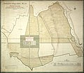
Stadshagen 1772.jpg 1,926 × 1,773; 932 KB
-
The ancient Tegesta, now promontory of east Florida ... (2674725377).jpg 2,000 × 1,404; 2.83 MB
-
The Ancient Tegesta, now Promontory of East Florida. LOC 73694436.tif 6,228 × 4,013; 71.51 MB
-
Wereldkaart Waereld-Kaart (titel op object), RP-P-1935-796.jpg 4,798 × 3,030; 2.98 MB
-
Zazhevichy 1772 01.jpg 308 × 203; 6 KB
-
Крым. Карта Ахтиярской(Алхиарской) гавани в 1772г Бурнашев krym-1798.jpg 1,000 × 851; 157 KB


