Category:1770s maps of Pennsylvania
Jump to navigation
Jump to search
States of the United States: Alabama · Alaska · California · Connecticut · Delaware · Florida · Georgia · Illinois · Indiana · Kentucky · Louisiana · Maine · Maryland · Massachusetts · Mississippi · Missouri · New Hampshire · New Jersey · New York · North Carolina · Ohio · Pennsylvania · Rhode Island · South Carolina · Tennessee · Vermont · Virginia
Puerto Rico
Puerto Rico
Subcategories
This category has the following 10 subcategories, out of 10 total.
D
P
Media in category "1770s maps of Pennsylvania"
The following 8 files are in this category, out of 8 total.
-

-

-
-

-

-

-
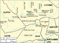 Big Runaway Map.PNG 493 × 357; 20 KB
-
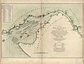
 Susquehanna River to Schuylkill River, Chesapeake Bay to Delaware Bay. NYPL484199.tiff 4,991 × 4,117; 58.79 MB
._LOC_79695387.jpg)


