Category:1770s maps of New York City
Jump to navigation
Jump to search
Media in category "1770s maps of New York City"
The following 42 files are in this category, out of 42 total.
-
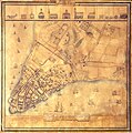
(A Plan of the city of New York. LOC gm71000646.jpg 5,208 × 6,468; 4.9 MB
-
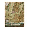
(New York Island. Military; unfinished. LOC gm71002309.jpg 3,341 × 5,066; 1.89 MB
-
1776NY300dpi.jpg 3,897 × 5,343; 13.66 MB
-
1776NY600dpiResize.pdf 500 × 689; 29.02 MB
-
1776NYC 1.jpeg 3,256 × 6,040; 7.09 MB
-
(King1893NYC) pg018 NEW YORK IN 1778, MAJOR HOLLAND'S MAP.jpg 1,628 × 1,311; 1.23 MB
-
275 of 'American Historic Towns' (11247774436).jpg 1,496 × 1,683; 585 KB
-
Eldridge Street in A Plan of the City of New York (1776).jpg 1,900 × 1,499; 899 KB
-
Forthillmap.jpg 1,420 × 660; 233 KB
-
Manual of the corporation of the city of New York (1859) (14763656835).jpg 1,872 × 3,200; 1.53 MB
-
Map of Brooklyn and Lower Manhattan in September 1776 (34 MB).jpg 8,663 × 6,154; 32.79 MB
-
Map of Brooklyn and Lower Manhattan in September 1776 (4 MB).jpg 2,559 × 1,818; 3.48 MB
-
New York City harbor print.jpg 500 × 238; 89 KB
-
NYC1776 crop.jpg 2,706 × 2,545; 4.65 MB
-
NYC1776 labelled.jpg 4,360 × 3,360; 7.88 MB
-
NYC1776.jpg 4,360 × 3,360; 6.9 MB
-
Philipsburg Manor - Westchester and Bronx Counties 1778 edit.jpg 4,920 × 7,280; 25.28 MB
-
Philipsburg Manor - Westchester and Bronx Counties 1778.jpg 4,920 × 7,280; 29.77 MB
-
Plan of the City of New York by Bernard Ratzer, 1767.jpg 8,192 × 8,192; 11.81 MB
-
Ratzer lower Manhattan 2.jpg 5,435 × 3,684; 9.02 MB
-
Simcoe map.jpg 475 × 401; 58 KB
-
Stuyvesant Farm from The Plan of the City of New York in North America by Ratzer 1770.jpg 1,956 × 2,360; 2.63 MB
-
The Hessians - Battle of Long Island.jpg 1,854 × 1,323; 460 KB


