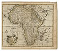
Category:1760 maps of Africa
Jump to navigation
Jump to search
Temperate regions: North America · South America · Africa · Europe · Asia · – Polar regions: – Other regions:
| 1760 1761 1762 1763 1764 1765 1766 1767 1768 1769 → |
Media in category "1760 maps of Africa"
The following 9 files are in this category, out of 9 total.
-
Resized-inu-afrmap-4007241-recto-master.png 3,411 × 2,957; 20 MB
-
AMH-2484-NA Map of Cape of Good Hope.jpg 2,400 × 1,601; 601 KB
-
AMH-5601-NA Map of the Cape of Good Hope and False Bay.jpg 2,400 × 1,651; 512 KB
-
Carte de Tunis et Golfe de Tunis - 1760.jpg 400 × 306; 23 KB
-
L'Afrique divisée en ses principaux Etats... - par le Sr Janvier... - btv1b84690527.jpg 11,626 × 8,455; 14.67 MB
-
Lobeck-Lotter Africa 1760 UTA.jpg 2,057 × 1,643; 1.43 MB
-
T K Empire of Morocco.jpg 720 × 478; 93 KB
-
Tunis - 1760.jpg 3,000 × 2,299; 1.02 MB


