Category:1755 maps of Canada
Jump to navigation
Jump to search
Countries of the Americas: Canada · United States of America
Provinces and territories of Canada: Ontario ·
Subcategories
This category has the following 2 subcategories, out of 2 total.
*
- 1755 Mitchell Map (24 F)
O
- 1755 maps of Ontario (2 F)
Media in category "1755 maps of Canada"
The following 10 files are in this category, out of 10 total.
-
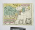
A map of the British and French settlements in North America (4071880581).jpg 2,000 × 1,377; 2.87 MB
-
Fort Dauphin 1.jpg 900 × 625; 140 KB
-
Mi'kmaq History Month (21192149713).jpg 4,500 × 3,527; 2.49 MB
-
A Map of the British and French settlements in North America (NYPL b15180032-434069).tiff 4,698 × 3,944; 53.02 MB
-
Canada et Louisiane (NYPL b15304237-434488).jpg 4,848 × 5,907; 6.13 MB
-
Partie orientale de la Nouvelle France ou du Canada (4231297623).jpg 2,000 × 1,597; 3.44 MB
-
Partie orientale de la Nouvelle France ou du Canada (4231297773).jpg 2,000 × 1,653; 3.55 MB
-
Partie orientale de la Nouvelle France ou du Canada.jpg 4,288 × 3,443; 2.74 MB
-
Plan de la ville de Quebec - 1755.jpg 6,089 × 4,280; 10.5 MB


