Category:1753 maps
Jump to navigation
Jump to search
| ← · 1750 · 1751 · 1752 · 1753 · 1754 · 1755 · 1756 · 1757 · 1758 · 1759 · → |
Deutsch: Karten mit Bezug zum Jahr 1753
English: Maps related to the year 1753
Español: Mapas relativos al año 1753
Français : Cartes concernant l’an 1753
Русский: Карты 1753 года
Subcategories
This category has the following 9 subcategories, out of 9 total.
A
E
N
S
T
Media in category "1753 maps"
The following 83 files are in this category, out of 83 total.
-
Ark 12148 btv1b550041170.jpg 14,574 × 4,744; 3.41 MB
-
Ark 12148 btv1b55008500b.jpg 21,607 × 5,392; 7.14 MB
-
1753 plano ciudad de México.jpg 1,000 × 1,242; 482 KB
-
A chart of the sea coast of Spain from the straits mouth to C de Gat (FL13722341 2471232).jpg 9,196 × 7,546; 96.57 MB
-
A general plan of Annapolis Royal LOC 74691226.tif 9,014 × 7,877; 203.14 MB
-
A map of Philadelphia and parts adjacent - by N. Scull and G. Heap. NYPL433956.tiff 4,928 × 5,147; 72.57 MB
-
A Map of the western parts of the province of Pennsylvania, Virginia, etc. LOC gm71002323.tif 4,656 × 6,494; 86.51 MB
-
A new and exact plan of Cape Fear River, from the bar to Brunswick, LOC 74692771.jpg 4,803 × 5,627; 2.83 MB
-
A new and exact plan of Cape Fear River, from the bar to Brunswick, LOC 74692771.tif 4,803 × 5,627; 77.32 MB
-
AMH-2530-NA Chart of Table Bay.jpg 2,400 × 2,027; 1.16 MB
-
AMH-2642-NA Map of Table Bay.jpg 2,400 × 2,114; 971 KB
-
AMH-5500-NA Seachart of Mozambique and Madagascar.jpg 2,400 × 1,407; 706 KB
-
AMH-6543-NA Maps of Panengamo and Parengietoecoelam.jpg 2,400 × 1,816; 434 KB
-
AMH-6545-NA Maps of Welligam Corle and Morrua Corle.jpg 2,400 × 1,844; 336 KB
-
AMH-6546-NA Map of Dolosdas Corle.jpg 2,400 × 1,872; 391 KB
-
AMH-6892-NA Two maps of Hapitigam Corle and Alloetcoer Corle.jpg 2,400 × 1,688; 394 KB
-
AMH-6895-NA Two maps of Hina Corle and Hewegam Corle.jpg 2,400 × 1,691; 380 KB
-
AMH-7981-KB Map of Malacca.jpg 1,725 × 2,400; 620 KB
-
AMH-7988-KB Map of Punto Galle.jpg 1,687 × 2,400; 736 KB
-
AMH-8000-KB Bird's eye view of Jaffnapatnam.jpg 2,400 × 1,815; 1.01 MB
-
AMH-8001-KB Map of the Bay of Tricomale.jpg 2,400 × 1,865; 704 KB
-
AMH-8006-KB Bird's eye view of the city of Judia in Siam.jpg 2,400 × 1,738; 1.14 MB
-
AMH-8008-KB Map of the city of Siam.jpg 2,400 × 1,650; 816 KB
-
AMH-8009-KB Map of the Menam River, with Bangkok and Ayuthaya.jpg 1,650 × 2,400; 670 KB
-
AMH-8089-KB Map of Australia.jpg 2,400 × 1,816; 693 KB
-
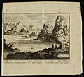
Antoine Augustin Calmet, Abbildung des Oelbergs (FL6880900 2481969).jpg 2,629 × 2,380; 3.52 MB
-
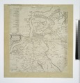
Antoine Augustin Calmet, Karte von der Lage des Paradieses (FL200036759 2368455).jpg 2,260 × 2,968; 9.78 MB
-
Antoine Augustin Calmet, Karte von der Lage des Paradieses (FL25567808 2368453).jpg 4,353 × 5,440; 30.61 MB
-
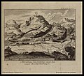
Antoine Augustin Calmet, Prospect der Berge Sinai und Horeb (FL147393505 2482025).jpg 2,866 × 2,600; 6.95 MB
-
AriAtoll 1753.jpg 3,475 × 3,240; 1.75 MB
-
Beveland 1753 Hattinga Tirion.jpg 3,419 × 1,897; 3.4 MB
-
Beveland N 1753 Hattinga Tirion².jpg 2,372 × 1,859; 2.22 MB
-
Buache1753Map.jpg 2,811 × 1,923; 1,001 KB
-
Compass rose in 1753, from Ari Atoll 1753 (cropped).jpg 265 × 325; 70 KB
-
Delisle - Carte génerale des Découvertes de l'Amiral de Fonte.jpg 3,271 × 2,237; 1.22 MB
-
Didier Robert de Vaugondy, Carte de l'Egypte ancienne et moderne (FL25570374 2504060).jpg 13,900 × 19,729; 378.05 MB
-
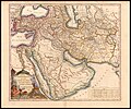
Didier Robert de Vaugondy, Etats du Grand Seigneur en Asie (FL35865419 2492247).jpg 15,341 × 12,746; 271.61 MB
-
Draft of the lands disputed by Philipse Patent against Beekmans & Rambaults. LOC gm71002312.tif 16,727 × 6,650; 318.24 MB
-
Goes diverse gezichten + plattegrond.jpg 5,293 × 3,480; 8.37 MB
-
Huvadu 1753.jpg 3,244 × 2,813; 4 MB
-
Jacques-Nicolas Bellin, Carte reduite des costes Occidentales d'Afrique (FL13727099 2497494).jpg 14,601 × 10,504; 227.29 MB
-
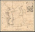
John Elton, A plain chart of the Caspian sea (FL37807993 3018404).jpg 14,045 × 9,741; 174.11 MB
-
John Gibson, The several routs, to and from Persia (FL35061594 2516849).jpg 13,754 × 8,835; 166.73 MB
-
Kaart van de Papaosche Eilanden - btv1b8494429n.jpg 6,400 × 5,357; 3.95 MB
-
1753 Van Keulen Maldives Map.jpg 5,921 × 6,787; 14.01 MB
-
Malmvik Nils Adolph Pontelius 1753.jpg 9,000 × 6,281; 3.53 MB
-
Manche-Van Loon 1753.jpg 5,500 × 4,090; 1.8 MB
-
Map spb 1753 high.jpg 2,284 × 1,557; 562 KB
-
Mappa Mundi generalis, 1753.jpg 5,167 × 3,759; 5.29 MB
-
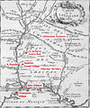
Montigny map with locations.jpg 863 × 1,036; 454 KB
-
Pregledni zemljevid Istre leta 1753.jpg 10,680 × 8,095; 10.84 MB
-
Reise der Israëliten Durch die Wüste, Von Egypten aus, bis an den Jordan (FL6881081 2370307).jpg 6,600 × 3,784; 37.97 MB
-
Schouwen 1753.jpg 4,638 × 2,492; 10.3 MB
-
Thionville 1753.jpg 669 × 512; 143 KB
-
Tholen 1753 Hattinga Tirion.jpg 2,300 × 1,923; 2.59 MB
-
Van Keulen - De Z. O. Haven van 't Eyland Mauritius.jpg 1,716 × 1,506; 1.98 MB
-
Walcheren 1753 Tirion Hattinga.jpg 5,295 × 4,180; 26.04 MB
-
Zeeland 1753 Hattinga.jpg 4,841 × 4,345; 27.06 MB


