Category:1750s maps of Mexico
Jump to navigation
Jump to search
Media in category "1750s maps of Mexico"
The following 7 files are in this category, out of 7 total.
-
Mapa de los cerros del Real de Minas de Pachuca, 1750..jpg 4,252 × 5,974; 4.47 MB
-
Le Mexique conquis (1752) (14598374838).jpg 2,716 × 2,328; 1.31 MB
-
1753 plano ciudad de México.jpg 1,000 × 1,242; 482 KB
-
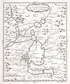
1754 Bellin Map of Mexico City ^ Environs - Geographicus - MexicoCity2-bellin-1754.jpg 2,095 × 2,508; 1.03 MB


