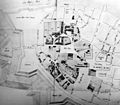
Category:1750s maps of Bremen (state)
Jump to navigation
Jump to search
Federal states of Germany:
Media in category "1750s maps of Bremen (state)"
The following 4 files are in this category, out of 4 total.
-
Bremer Dombezirk - Johann Christian Dankwerth - 1750.jpg 1,447 × 1,262; 1.08 MB
-
Brema Seutter 1755.jpg 1,362 × 1,169; 2.1 MB
-
Bremen 1757.jpg 824 × 500; 86 KB
-
Bremen mit Vorstaedten 1757 Heinbach.jpg 3,656 × 2,205; 8.4 MB


