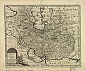
Category:1747 Persia map by Emanuel Bowen
Jump to navigation
Jump to search
Media in category "1747 Persia map by Emanuel Bowen"
The following 22 files are in this category, out of 22 total.
-
Bowen, Emanuel. Persia, adjacent countries. 1747 (A).jpg 4,038 × 3,338; 3.45 MB
-
Bowen, Emanuel. Persia, adjacent countries. 1747.jpg 5,789 × 4,273; 4.66 MB
-
New and accurate map of Persia.jpg 5,664 × 4,715; 7.23 MB
-
Persian(IRAN) Empire 1747.jpg 5,420 × 4,548; 8.38 MB
-
Aras River in Persian (IRAN) Empire 1747 map.JPG 1,223 × 445; 77 KB
-
Bowen, Emanuel. Persia, adjacent countries. 1747 (B).jpg 1,865 × 1,279; 658 KB
-
Bowen, Emanuel. Persia, adjacent countries. 1747 (BA).jpg 1,120 × 756; 292 KB
-
Bowen, Emanuel. Persia, adjacent countries. 1747 (BB).jpg 761 × 691; 191 KB
-
Bowen, Emanuel. Persia, adjacent countries. 1747 (BC).jpg 986 × 870; 281 KB
-
Bowen, Emanuel. Persia, adjacent countries. 1747 (C).jpg 1,608 × 1,402; 724 KB
-
Bowen, Emanuel. Persia, adjacent countries. 1747 (D).jpg 1,899 × 2,948; 1.47 MB
-
Bowen, Emanuel. Persia, adjacent countries. 1747 (DA).jpg 1,899 × 1,258; 576 KB
-
Bowen, Emanuel. Persia, adjacent countries. 1747 (DB).jpg 1,899 × 1,184; 725 KB
-
Bowen, Emanuel. Persia, adjacent countries. 1747 (DC).jpg 1,899 × 1,055; 609 KB
-
Bowen, Emanuel. Persia, adjacent countries. 1747 (E).jpg 1,067 × 985; 301 KB
-
Caspian sea in Persian (IRAN) Empire 1747.JPG 512 × 729; 84 KB
-
Map of Afghanistan during the Safavid and Moghul Empire.jpg 2,532 × 1,736; 1.16 MB
-
Persian(IRAN) Empire 1747 (A).JPG 1,513 × 874; 242 KB
-
Persian(IRAN) Empire 1747 (B).JPG 1,173 × 616; 144 KB
-
گیلان در نقشه امپراطوری افشاریه سال 1747 میادی.jpg 817 × 753; 118 KB


