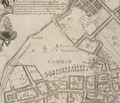
Category:1743 maps of Boston
Jump to navigation
Jump to search
Media in category "1743 maps of Boston"
The following 18 files are in this category, out of 18 total.
-
1743 BeaconHill Boston map WilliamPrice.png 812 × 714; 999 KB
-
1743 BostonCommon map WilliamPrice.png 811 × 694; 715 KB
-
1743 BrattleSt Boston map WilliamPrice.png 817 × 720; 1.01 MB
-
1743 Clark Square NorthEnd Boston map WilliamPrice BPL 10913 detail.png 810 × 575; 1.02 MB
-
1743 Copps Hill NorthEnd Boston map WilliamPrice BPL 10913 detail.png 810 × 575; 1.02 MB
-
1743 Cornhill Boston map WilliamPrice.png 965 × 553; 1.04 MB
-
1743 EssexSt Boston map WilliamPrice.png 809 × 716; 1.11 MB
-
1743 FinancialDistrict Boston map WilliamPrice.png 808 × 719; 1.04 MB
-
1743 LongWharf Boston map WilliamPrice.png 827 × 719; 905 KB
-
1743 MerchantsRow Boston map WilliamPrice.png 809 × 716; 1.07 MB
-
1743 NorthEnd Boston map WilliamPrice.png 810 × 575; 865 KB
-
1743 Prison QueenSt Boston map WilliamPrice.png 799 × 713; 1.05 MB
-
1743 ProvinceHouse Boston map WilliamPrice.png 725 × 614; 963 KB
-
1743 SchoolSt Boston map WilliamPrice.png 811 × 718; 1,010 KB
-
1743 SummerSt Boston map WilliamPrice.png 725 × 614; 801 KB


