Category:1740s maps of Georgia (U.S. state)
Jump to navigation
Jump to search
States of the United States: Connecticut · Delaware · Florida · Georgia · Louisiana · Massachusetts · New Hampshire · New Jersey · New York · North Carolina · Pennsylvania · South Carolina · Virginia
Media in category "1740s maps of Georgia (U.S. state)"
The following 3 files are in this category, out of 3 total.
-
 1746 Herman Moll Map of Carolina - Geographicus - CarolinabyMoll-moll-1746.jpg 3,400 × 2,494; 2.96 MB
-

-
 Carte des costes de la Floride Françoise, suivant les premieres découvertes (3120844840).jpg 1,508 × 2,000; 3.26 MB

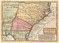
_-_Geographicus_-_CarolinaGeorgia-bowen-1747.jpg)
.jpg)