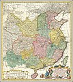
Category:1740s maps of China
Jump to navigation
Jump to search
Subcategories
This category has the following 2 subcategories, out of 2 total.
- 1746 maps of China (4 F)
H
- Huang He xia you zha ba tu (40 F)
Media in category "1740s maps of China"
The following 26 files are in this category, out of 26 total.
-
1740 map of China, published by Homann Heirs.jpg 12,726 × 14,291; 45.99 MB
-
1740 map of China, published by Homannsche Erben.jpg 12,536 × 14,169; 45.43 MB
-
Ca. 1740 map of China, published by Homannsche Erben.jpg 12,863 × 14,455; 32.53 MB
-
AMH-8182-KB Map of China.jpg 2,400 × 2,104; 1.37 MB
-
Map Japan 1746.JPG 409 × 295; 20 KB
-
AMH-7930-KB Map of Japan, China and Korea.jpg 2,400 × 1,815; 837 KB
-
Cartouche in map of China by Nicolas Bellin.tif 1,552 × 1,652; 7.34 MB
-
L'Empire de la Chine pour servir a L'histoire générale des voyages LOC 2006629393.jpg 6,810 × 5,064; 6.37 MB
-
L'Empire de la Chine pour servir a L'histoire générale des voyages LOC 2006629393.tif 6,810 × 5,064; 98.67 MB
-
Canton Thirteen Factories map 1748-49 enhanced with translations.jpg 3,578 × 2,613; 4.73 MB
-
1749 map Chinese Tartary by Tobias Mayer.jpg 19,690 × 12,721; 45.11 MB
-
Tatariae Sinensis mappa geographica 1749 24374665.jpg 13,080 × 7,036; 22.5 MB
-
AMH-7966-KB Map of China and Korea.jpg 2,400 × 2,241; 1.29 MB
-
KKR-20 La CHINE avec la Korée et les Parties de la Tartarie.jpg 3,148 × 2,584; 1.1 MB
-
BienGioiVietTrung1740.jpg 1,920 × 500; 601 KB
-
Ca. 1740 map of China, published by Homann Heirs.jpg 12,577 × 14,235; 40.47 MB
-
China1740.jpg 1,400 × 1,564; 3.29 MB
-
Navigantium atque itinerantium bibliotheca Fleuron N010532-44.png 2,935 × 517; 55 KB


