Category:1730s maps of Saxony-Anhalt
Jump to navigation
Jump to search
|
Federal states of Germany: |
Media in category "1730s maps of Saxony-Anhalt"
The following 4 files are in this category, out of 4 total.
-
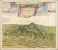
1732 illustration of Blocksberg.jpg 14,017 × 12,060; 25.49 MB


