Category:1730s maps of Eastern Europe
Jump to navigation
Jump to search
| 18th-century maps of Eastern Europe: ← 1700s 1710s 1720s 1730s 1740s 1750s 1760s 1770s 1780s 1790s → |
Media in category "1730s maps of Eastern Europe"
The following 6 files are in this category, out of 6 total.
-
Map of Russia and Poland 1730.jpg 12,048 × 7,509; 32.78 MB
-
Map of Moscovy, Poland, Little Tartary, and ye Black Sea etc NYPL1630438.tiff 7,070 × 5,084; 102.84 MB
-
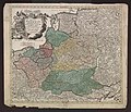
Polen BV022294147.jpg 10,369 × 8,858; 11.91 MB
-
Balkanhalbinsel BV044690449.jpg 9,739 × 8,320; 9.35 MB


