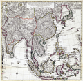
Category:1730 maps of Asia
Jump to navigation
Jump to search
Temperate regions: North America · South America · Africa · Europe · Asia · – Polar regions: – Other regions:
English: 1730 maps of Asia
Español: Mapas de Asia en 1730
Subcategories
This category has the following 3 subcategories, out of 3 total.
I
- 1730 maps of Iran (6 F)
Media in category "1730 maps of Asia"
The following 7 files are in this category, out of 7 total.
-
1730 map of Asia by Herman Moll.jpg 23,521 × 14,382; 72.95 MB
-
1730 map of Russia and Tartary by Johann Matthias Hase.jpg 13,412 × 11,835; 29.39 MB
-
1730 Van Verden Map of the Caspian Sea - Geographicus - CaspienSea-vanverden-1721.jpg 2,310 × 3,500; 2.23 MB
-
Carte des Indes et de la Chine.png 4,790 × 4,623; 31.33 MB
-
Chechen Island on a map of 1730.png 495 × 658; 797 KB
-
Homann map of Japan (Iaponia) 1730.jpg 1,000 × 815; 795 KB


