Category:1714 maps
Jump to navigation
Jump to search
| ← · 1710 · 1711 · 1712 · 1713 · 1714 · 1715 · 1716 · 1717 · 1718 · 1719 · → |
Deutsch: Karten mit Bezug zum Jahr 1714
English: Maps related to the year 1714
Español: Mapas relativos al año 1714
Français : Cartes concernant l’an 1714
Русский: Карты 1714 года
Subcategories
This category has the following 3 subcategories, out of 3 total.
Media in category "1714 maps"
The following 45 files are in this category, out of 45 total.
-
A draught of part of the Meditteranean Sea (FL13730440 3365550).jpg 9,657 × 7,598; 93.39 MB
-
Adriaan Reland, Conspectus Palaestinae in tabula veteri itineraria (FL6880931 2656916).jpg 2,362 × 1,346; 5.36 MB
-
Adriaan Reland, Facies regionis Philistaeorum (FL200878782 2368966).jpg 2,284 × 3,096; 9.85 MB
-
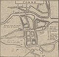
Corke 1714 (Moll).jpg 1,538 × 1,484; 568 KB
-
Domhof 1714.jpg 1,622 × 2,594; 1.91 MB
-
Feuillée-Carte-Amérique du sud.jpg 1,325 × 995; 565 KB
-
Gallway 1714 (Moll).jpg 1,128 × 855; 227 KB
-
Gyants Cawsway 1714 (Moll).jpg 1,704 × 855; 284 KB
-
Gyants Cawsway 1714b (Moll).jpg 1,146 × 844; 198 KB
-
Hemisphere Septentrional pour voir plus distinctement les Terres Arctiques (12326436644).jpg 1,987 × 2,000; 2.01 MB
-
Henry Maundrell, Mount Carmel (FL6878756 2370282).jpg 1,267 × 2,197; 1.35 MB
-
Henry Maundrell, Mount Tabor (FL6882113 2370281).jpg 1,341 × 2,238; 1.51 MB
-
Isle of St Patrick's Purgatory 1714 (Moll).jpg 1,704 × 853; 253 KB
-
Isle of St Patrick's Purgatory 1714b (Moll).jpg 692 × 852; 104 KB
-
Kinsale 1714 (Moll).jpg 1,323 × 936; 213 KB
-
L'Afrique suivant les premiers voyages par Mer des Portugais.jpg 800 × 535; 211 KB
-
La journée de Poltawa en Ukraine, le 8-e juillet 1709.jpg 3,000 × 2,009; 1.86 MB
-
La Turquie en Europa by Abraham Du Bois 1714.jpg 1,600 × 1,298; 552 KB
-
Limrick 1714 (Moll).jpg 1,331 × 1,243; 396 KB
-
Map of Livingston Manor, 1714 NYPL1693087.tiff 6,285 × 4,853, 2 pages; 90.76 MB
-
Mapa Terminos municipales en Hoya de Buñol (año 1714).jpg 6,768 × 4,349; 3.01 MB
-
Mappe-monde ou carte universelle - par N. de Fer... - btv1b8491189z.jpg 5,939 × 4,140; 4.13 MB
-
Mappe-monde, ou carte universelle LOC 2017585632.jpg 4,968 × 3,584; 3.29 MB
-
Mappe-monde, ou carte universelle LOC 2017585632.tif 4,968 × 3,584; 50.94 MB
-
Moll - The north part of Great Britain called Scotland.png 2,144 × 1,224; 3.6 MB
-
Tabula Ducatus Carnioliae, Vindorum Marchiae et Histriae.jpg 6,897 × 5,764; 47.63 MB
-
Vincenzo Coronelli, Chorographia Palestinæ (FL13733965 3532282).jpg 8,332 × 3,904; 51.7 MB
-
Waterford 1714 (Moll).jpg 1,115 × 870; 241 KB
-
康熙皇輿全覽圖.jpg 2,433 × 3,014; 1.08 MB


