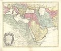
Category:1710s maps of the Ottoman Empire
Jump to navigation
Jump to search
Great Britain · Habsburg Monarchy · Holy Roman Empire · Polish-Lithuanian Commonwealth · Ottoman Empire · Tsardom of Russia ·
Subcategories
This category has the following 12 subcategories, out of 12 total.
'
- 1710s maps of Bulgaria (empty)
- 1710s maps of Greece (5 F)
.
- 1710s maps of Iraq (4 F)
- 1710s maps of Palestine (2 F)
- 1710s maps of Serbia (9 F)
- 1710s maps of Syria (2 F)
Media in category "1710s maps of the Ottoman Empire"
The following 9 files are in this category, out of 9 total.
-
1710 map of the Ottoman Empire by Henri Chatelain.jpg 13,126 × 10,292; 25.83 MB
-
1710年的奥斯曼帝国.png 1,357 × 628; 35 KB
-
Map - Special Collections University of Amsterdam - OTM- HB-KZL 33.05.60.tif 7,679 × 6,405; 140.72 MB
-
1711 map of the Battle of Stănileşti of the Pruth River Campaign by Nicolaes Visscher II.jpg 12,444 × 11,230; 27.95 MB
-
Ca, 1717 Dutch map of the Aegean Sea.jpg 27,480 × 13,658; 51.76 MB
-
Imperium Turcicum in Europa, Asia Et Africa.jpg 7,092 × 6,057; 16.29 MB


