Category:1710 maps of Europe
Jump to navigation
Jump to search
English: 1710 maps of Europe
Español: Mapas de Europa en 1710
Suomi: Euroopan kartat vuodelta 1710
Română: Hărți ale Europei din 1710
Subcategories
This category has the following 6 subcategories, out of 6 total.
Media in category "1710 maps of Europe"
The following 6 files are in this category, out of 6 total.
-
Carte Crach 1710.jpg 306 × 446; 165 KB
-
Grundriss der Statt Douay mit dem ungefähr 800 Ruthen davon entlegene... - CBT 6626057.jpg 5,969 × 4,704; 11.49 MB
-
Grundriss der Statt und Vestung Bethune, solche wurde Ao. 1710 vom... - CBT 6626064.jpg 5,842 × 4,727; 12.08 MB
-
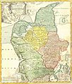
1710 Homann Map of Denmark "Iutiae" - Geographicus - Iutiae-homann-1710.jpg 2,500 × 2,935; 2.42 MB


