Category:1705 maps
Jump to navigation
Jump to search
| ← · 1700 · 1701 · 1702 · 1703 · 1704 · 1705 · 1706 · 1707 · 1708 · 1709 · → |
Deutsch: Karten mit Bezug zum Jahr 1705
English: Maps related to the year 1705
Español: Mapas relativos al año 1705
Français : Cartes concernant l’an 1705
Русский: Карты 1705 года
Subcategories
This category has the following 9 subcategories, out of 9 total.
Media in category "1705 maps"
The following 70 files are in this category, out of 70 total.
-
America-1705.jpg 1,649 × 2,555; 1.86 MB
-
America. NYPL433852.tiff 5,152 × 4,931; 72.69 MB
-
AMH-6666-KB Map of Japan.jpg 2,400 × 1,872; 907 KB
-
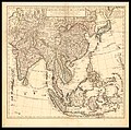
Asia (1705).jpg 4,660 × 4,327; 3.45 MB
-
Bernardinus Surius, Bergh Carmelus (FL6878318 2370204).jpg 3,056 × 2,020; 3.05 MB
-
Bernardinus Surius, Den Olyf Bergh (FL6878561 2370189).jpg 1,560 × 2,836; 2.3 MB
-
Bernardinus Surius, Jerusalem (FL6880809 2368191).jpg 1,566 × 3,490; 2.9 MB
-
Bernardinus Surius, Palestine (FL45585337 3928581).jpg 2,958 × 2,056; 1.41 MB
-
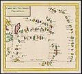
Carte des Nouvelles Philippines.jpg 1,089 × 1,000; 969 KB
-
Carte du Gouvernement de lAmerique (4072630986).jpg 2,000 × 1,565; 3.67 MB
-
Carte forret de Saint-Germain-en-Laye, 1705.jpg 433 × 640; 49 KB
-
Carte historique des Royaumes d'Espagne et Portugal.jpg 2,795 × 2,313; 5.1 MB
-
Evesché de Luçon (5121156382).jpg 2,000 × 1,448; 2.77 MB
-
Guillaume Delisle, Carte des Indes et de la Chine (FL27950790 2469324).jpg 17,278 × 17,140; 435.47 MB
-
Guillaume Sanson, Creta Insula (FL35071143 2530914).jpg 14,909 × 12,097; 241.08 MB
-
Hemisphere oriental du globe terrestre (1705).png 2,642 × 2,508; 11.3 MB
-
Huitieme plan de Paris divisé en ses vingts quartiers LOC 2001620493.jpg 6,946 × 5,633; 8.8 MB
-
Huitieme plan de Paris divisé en ses vingts quartiers LOC 2001620493.tif 6,946 × 5,633; 111.94 MB
-
Iohn Gaudy, A Chart of the Levant or the sea coast of Egypt Syria Caramania (FL13730698 3366244).jpg 11,243 × 8,502; 126.01 MB
-
Iohn Gaudy, Barcelona (FL13722981 2472279).jpg 8,557 × 7,324; 84.62 MB
-
Jerusalem, die Stadt, die Gott für allen libte (FL32714824 3876399).jpg 5,438 × 8,739; 67.98 MB
-
Johann Ulrich Kraus, Bethlehem 01 (FL33141933 3876384).jpg 4,844 × 7,362; 53.44 MB
-
Johann Ulrich Kraus, Bethlehem 02-title-page (FL33141941 3876384).jpg 4,877 × 7,207; 43.82 MB
-
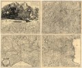
Karta över postrouterna i Frankrike, 1705 - Skoklosters slott - 97965.tif 3,980 × 3,709, 2 pages; 42.25 MB
-
La Palestine, Iudee, Terre promise ou Terre Sainte (FL37122042 3898754).jpg 2,554 × 1,753; 3.07 MB
-
Le de troit de Gibraltar ou sont exactement observee la maree &c. RMG F0083.tiff 7,250 × 4,788; 99.31 MB
-
Le grand teatre de la guerre en Italie. LOC 2002624054.jpg 14,840 × 12,314; 38.78 MB
-
Le grand teatre de la guerre en Italie. LOC 2002624054.tif 14,840 × 12,314; 522.82 MB
-
Map of part of Roman Empire in the fourth century (1705).jpg 7,430 × 5,631; 7.85 MB
-
Mappe-monde ou carte générale de la terre LOC 83694566.jpg 4,615 × 3,149; 2.42 MB
-
Mappe-monde ou carte générale de la terre LOC 83694566.tif 4,615 × 3,149; 41.58 MB
-
Mappe-monde ou carte générale de la terre LOC 83694567.jpg 4,527 × 3,256; 2.38 MB
-
Mappe-monde ou carte générale de la terre LOC 83694567.tif 4,527 × 3,256; 42.17 MB
-
Michael Burghers, A new map of ancient Asia (FL32697906 2485283).jpg 14,843 × 10,808; 202.94 MB
-
Michael Burghers, A new map of present Asia (FL32697967 2485286).jpg 14,695 × 10,687; 220.66 MB
-
Nicolaas Witsen. De Caspische Zee. 1705.jpg 3,299 × 5,873; 2.17 MB
-
Nicolas de Fer, Cadis (FL13722299 2471199).jpg 6,192 × 4,352; 36.8 MB
-
Nicolas de Fer, Cadis son port, sa Rade et ses environs (FL147556145 2470994).jpg 4,913 × 3,450; 21.2 MB
-
Nicolas de Fer, Cap de Bonne Esperance (FL167448393 2369927).jpg 8,922 × 6,657; 74.08 MB
-
Nicolas de Fer, Estats du grand duc de Moscovie (FL147398528 2608042).jpg 6,467 × 4,649; 32.45 MB
-
Nicolas de Fer, Hongrie (FL147394505 2608046).jpg 6,444 × 4,547; 31.34 MB
-
Nicolas de Fer, Huitieme plan de Paris divisé en ses vingts quartiers, 1705.jpg 6,742 × 5,442; 18.02 MB
-
Nicolas de Fer, Huitieme plan de Paris divisé en ses vingts quartiers, 1705.tiff 6,946 × 5,633; 111.96 MB
-
Nicolas de Fer, L' Asie (FL27957612 2480916).jpg 8,651 × 6,067; 66.42 MB
-
Nicolas de Fer, La Perse, la Georgie et la Turquie d'Asie (FL13728990 2514687).jpg 6,237 × 4,254; 38.46 MB
-
Nicolas Sanson, Sarmatia Utraque Europaea et Asiatica (FL36378870 2605370).jpg 14,860 × 11,848; 242.85 MB
-
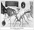
Petrovo1.jpg 600 × 532; 75 KB
-
Pierre Daniel Huet, Carte de la situation du Paradis Terrestre (FL6879125 2523225).jpg 2,757 × 2,260; 2.28 MB
-
Pieter Mortier I, Thracia vetus (FL36010874 2718574).jpg 14,886 × 11,817; 241.53 MB
-
Planisphere celeste septentrional ; Planisphere celeste meridional LOC 2012590168.jpg 11,249 × 5,895; 14.3 MB
-
Planisphere celeste septentrional ; Planisphere celeste meridional LOC 2012590168.tif 11,249 × 5,895; 189.72 MB
-
Plano de Madrid hacia 1705.jpg 2,417 × 1,586; 5.04 MB
-
Plaza de San Francisco, Plano de Madrid hacia 1705 (cropped).jpg 210 × 258; 112 KB
-
Plaza de Santa Bárbara, Plano de Madrid hacia 1705 (cropped).jpg 259 × 315; 149 KB
-
Prevote de Luxembourg reprod 1705.jpg 2,745 × 2,453; 1.46 MB
-
Prevote de Thionville reprod 1705.jpg 2,892 × 2,140; 1.48 MB
-
Witsen - Tartaria.jpg 3,675 × 3,080; 4.18 MB


