Category:1700s maps of Saarland
Jump to navigation
Jump to search
Federal states of Germany:
Media in category "1700s maps of Saarland"
The following 10 files are in this category, out of 10 total.
-
-
-

-

-
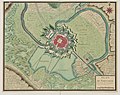
 Schloss Blieskastel - Plan der Schlossanlage 1704.jpg 3,000 × 1,957; 2.23 MB
-
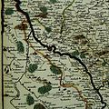 HistorischeKarteSaar1705L1060680 (2).jpg 2,736 × 2,736; 2.29 MB
-
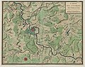
 LASB K Hellwig 0849.jpg 4,572 × 2,959; 1.33 MB
-
 LASB K Hellwig 1057.jpg 4,980 × 3,133; 2.87 MB
-
 LASB K Hellwig 1059.jpg 3,875 × 3,018; 2.62 MB
-
 LASB K Hellwig 1060.jpg 5,597 × 3,816; 2.39 MB
.jpg)
.jpg)
.jpg)
.jpg)

.jpg)


