Category:16th-century maps of Taiwan
Jump to navigation
Jump to search
maps of Taiwan by century: 16th century · 17th century · 18th century · 19th century · 20th century · 21st century ·
中文(臺灣):16世紀的臺灣地圖
Subcategories
This category has only the following subcategory.
Media in category "16th-century maps of Taiwan"
The following 11 files are in this category, out of 11 total.
-
A section of a 1570 map by Abraham Ortelius.jpeg 426 × 389; 114 KB
-
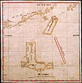
Map of Luzon, Isla Hermosa (Taiwan), and a Part of the Coast of China, 1597.jpg 1,000 × 1,049; 451 KB
-
台灣地圖.jpg 448 × 355; 25 KB


