Category:16th-century maps of North Carolina
Jump to navigation
Jump to search
States of the United States: Alaska · California · Florida · Georgia · Massachusetts · New York · North Carolina · South Carolina · Virginia
Puerto Rico
Puerto Rico
Media in category "16th-century maps of North Carolina"
The following 5 files are in this category, out of 5 total.
-

-
 Map of Virginia, Theodorus de Bry, 1591.jpg 1,878 × 1,379; 1.26 MB
-
 The Carte of all the Coast of Virginia by Theodor de Bry 1585 1586.jpg 1,000 × 739; 247 KB
-

-
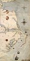 Roanoke map 1584.JPG 648 × 1,323; 466 KB


