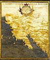
Category:16th-century maps of Mexico
Jump to navigation
Jump to search
Countries of North America: The Bahamas · Canada · Costa Rica · Cuba · Guatemala · Haiti · Honduras · Jamaica · Mexico · Panama · United States of America‡
Other territories: Bermuda · Greenland · Guadeloupe · Martinique · Puerto Rico
‡: partly located in North America
Other territories: Bermuda · Greenland · Guadeloupe · Martinique · Puerto Rico
‡: partly located in North America
Subcategories
This category has the following 6 subcategories, out of 6 total.
Media in category "16th-century maps of Mexico"
The following 24 files are in this category, out of 24 total.
-
Теночтитлан-1000x631.jpg 1,000 × 631; 361 KB
-
1528 - Bordone - Temistitan detalle abajo izquierda.jpg 1,560 × 857; 267 KB
-
1528 - Bordone - Temistitan detalle arriba derecha.jpg 1,673 × 1,030; 367 KB
-
1534 - Isolario di Benedetto Bordone - Temistitan.jpg 917 × 958; 287 KB
-
1565 Mexico Ramusio Delle Navigationi vol3 p308.png 545 × 863; 1.32 MB
-
Wytfliet Hispania Nova 1597 (1611) UTA.jpg 3,885 × 3,152; 12.37 MB
-
Cempoala, Mexico WDL438.png 1,249 × 1,024; 2.14 MB
-
Egnazio Danti - California - Google Art Project.jpg 6,554 × 7,774; 25.83 MB
-
Egnazio Danti - Mexico - Google Art Project.jpg 6,710 × 7,834; 26.96 MB
-
Gastaldi Nueva Hispania Tabula Nova 1548 UTA.jpg 2,620 × 2,100; 1.83 MB
-
HHBHM V2 D019 New Spain in the 16th century.jpg 3,618 × 1,842; 801 KB
-
Hispaniae novae sive magnae recens et vera descriptio - btv1b8446640m.jpg 7,232 × 5,569; 8.31 MB
-
Hispaniae Novae sive Magnae, recens et vera descriptio - btv1b8493400v.jpg 7,568 × 5,902; 8.43 MB
-
Los primeros poblados de Sinaloa.jpg 657 × 342; 34 KB
-
Mapa de Metztitlán - Relaciones geográficas de Indias (1579).jpg 8,614 × 5,873; 13.5 MB
-
Mapa de San Miguel y San Felipe de los Chichimecas (1580) - Chichimecas 2.jpg 3,860 × 2,790; 9.77 MB
-
Portolan chart of the Pacific coast from Mexico to northern Chile. LOC 2008628167.jpg 10,638 × 5,030; 5.42 MB
-
San Felipe, Guanajuato - Mapa de San Miguel y San Felipe de los Chichimecas (1580).jpg 3,679 × 2,759; 9.07 MB
-
The Oztoticpac Lands Map WDL106.jpg 2,623 × 2,388; 1.91 MB
-
Ortelius Guastecan 1584 (1603) UTA.jpg 867 × 690; 455 KB


