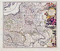
Category:1690s maps of Poland
Jump to navigation
Jump to search
Media in category "1690s maps of Poland"
The following 14 files are in this category, out of 14 total.
-
Atlante Veneto Volume 2 066.jpg 6,978 × 10,360; 7.91 MB
-
Atlante Veneto Volume 2 096.jpg 7,130 × 10,568; 7.68 MB
-
Atlante Veneto Volume 2 097.jpg 6,985 × 10,592; 7.04 MB
-
Atlante Veneto Volume 2 098.jpg 7,033 × 10,592; 7.79 MB
-
Atlante Veneto Volume 2 099.jpg 7,050 × 10,584; 7.75 MB
-
Estats De La Couronne De Pologne.jpg 1,593 × 1,300; 3.07 MB
-
Poland and Lit.jpg 7,600 × 6,400; 79.72 MB
-
Atlas Van der Hagen-KW1049B10 037-Tabula PRUSSIAE EXIMIA CURA CONSCRIPTA.jpeg 5,500 × 4,627; 4.39 MB
-
Germany from "L'Atlas en Abrege ou Nouvelle Description du Monde,".jpg 900 × 753; 491 KB
-
UBBasel Map Deutschland Niederlande Polen Schweiz 1692 Kartenslg Mappe 242-5.tif 17,554 × 11,164, 2 pages; 560.71 MB
-
Ziemia chełmska , ok. 1690.JPG 550 × 550; 347 KB
-
Mapaz muzeum w Helu A23.jpg 4,512 × 3,000; 6.11 MB


