Category:1681 maps
Jump to navigation
Jump to search
| ← · 1680 · 1681 · 1682 · 1683 · 1684 · 1685 · 1686 · 1687 · 1688 · 1689 · → |
Deutsch: Karten mit Bezug zum Jahr 1681
English: Maps related to the year 1681
Español: Mapas relativos al año 1681
Français : Cartes concernant l’an 1681
Русский: Карты 1681 года
Subcategories
This category has the following 8 subcategories, out of 8 total.
Media in category "1681 maps"
The following 80 files are in this category, out of 80 total.
-
1681. gads.jpg 750 × 750; 61 KB
-
Allard, Carel (1648-1709), Afb KOG-AA-3-02-075.jpg 6,984 × 5,940; 8.1 MB
-
America. NYPL430371.tiff 6,299 × 5,248; 94.6 MB
-
America.) NYPL1503413.tiff 5,248 × 5,691; 85.47 MB
-
AMH-7755-KB Map of Central American and the Caribbean region.jpg 2,400 × 1,992; 990 KB
-
AMH-7757-KB Map of North and South America.jpg 2,400 × 1,962; 954 KB
-
Arabia. NYPL1503440.tiff 4,792 × 2,739; 37.57 MB
-
Asia. NYPL1503438.tiff 6,299 × 5,248; 94.6 MB
-
Brazill and La Plata. NYPL1503454.tiff 5,248 × 6,299; 94.6 MB
-
Carniola Karstia Histria et Windorvm Marchia.jpg 1,499 × 1,133; 666 KB
-
Carte de la decouverte faite l'an 1673 dans l'Amerique Septentrionale LOC 2006629776.jpg 4,192 × 1,796; 1.41 MB
-
Carte de la decouverte faite l'an 1673 dans l'Amerique Septentrionale LOC 2006629776.tif 4,192 × 1,796; 21.54 MB
-
Carte de la découverte faite l'an 1673 dans l'Amérique septentrionale. LOC 2003627092.jpg 4,117 × 1,717; 1.34 MB
-
Carte de la découverte faite l'an 1673 dans l'Amérique septentrionale. LOC 2003627092.tif 4,117 × 1,717; 20.22 MB
-
China; Tartaria. NYPL1503443.tiff 6,299 × 5,248; 94.6 MB
-
Cicignons Byplan (1681).jpg 6,896 × 5,736; 8.27 MB
-
Danemark vizt Jutland, Zeland, Sleswick, Holstein. NYPL1503430.tiff 5,248 × 6,299; 94.6 MB
-
East India. NYPL1503442.tiff 3,888 × 4,915; 54.7 MB
-
England, Scotland and Ireland, with the iles thereto belonging. NYPL1503434.tiff 5,248 × 6,299; 94.6 MB
-
Europe. NYPL1503414.tiff 6,299 × 5,248; 94.6 MB
-
Flanders or the Spanish Provinces. NYPL1503421.tiff 6,299 × 5,184; 93.44 MB
-
France. NYPL1503417.tiff 6,299 × 5,248; 94.6 MB
-
Franche Connty. NYPL1503425.tiff 4,688 × 6,123; 82.15 MB
-
Gabriel Bucelin Karte Oberschwaben.jpg 2,708 × 4,423; 2.54 MB
-
Germany. NYPL1503423.tiff 6,259 × 5,112; 91.56 MB
-
Grafschaft Mark 1681 Nicolas Sanson.jpg 7,240 × 5,875; 10.2 MB
-
Grafschaft mark 1681 sanson-Ausschnitt.jpg 1,237 × 1,850; 2.63 MB
-
Grafschaft mark 1681 sanson.jpg 3,833 × 2,901; 9 MB
-
Guinea and Nigrita. NYPL1503447.tiff 6,299 × 5,248; 94.6 MB
-
Helvetia, or Swisserland. NYPL1503424.tiff 6,299 × 5,248; 94.6 MB
-
Holland or the United Provinces. NYPL1503422.tiff 6,299 × 5,248; 94.6 MB
-
Hungaria. NYPL1503427.tiff 6,299 × 5,248; 94.6 MB
-
Ireland. NYPL1503437.tiff 5,248 × 6,155; 92.44 MB
-
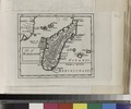
Isle of Madagascar. NYPL1503451.tiff 6,299 × 5,248; 94.6 MB
-
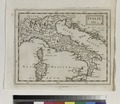
Italie. NYPL1503419.tiff 6,067 × 5,248; 91.12 MB
-
Marquette and jolliet map 1681 (rotated vertical).jpg 600 × 250; 69 KB
-
New England. NYPL433612.tiff 6,299 × 5,248; 94.6 MB
-
New Spain; Guiana. NYPL1503455.tiff 3,722 × 5,224; 55.65 MB
-
North Pole. NYPL1503459.tiff 5,643 × 5,160; 83.33 MB
-
Arabia (NYPL b14428893-1503440).jpg 6,299 × 5,248; 6.25 MB
-
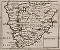
Monomotapa (NYPL b14428893-1503448) (cropped).jpg 3,436 × 2,881; 2.76 MB
-
Monomotapa (NYPL b14428893-1503448).jpg 6,299 × 5,248; 6.87 MB
-
Brazill and La Plata (NYPL b14428893-1503454).jpg 5,248 × 6,299; 7 MB
-
Olfert Dapper, De Olyf Bergh en Dal Iosaphat (FL51871485 2370168).jpg 7,123 × 5,707; 46.94 MB
-
Olfert Dapper, De Stadt Ierusalem zoot Hedendaeghs Bevonden wordt (FL51871425 2368034).jpg 7,015 × 5,658; 45.85 MB
-
Olfert Dapper, Ierusalem (FL51871458 2368031).jpg 7,843 × 3,856; 33.07 MB
-
Olfert Dapper, Jerusalem (FL51871467 2368028).jpg 7,597 × 5,519; 47.42 MB
-
Olfert Dapper, Jerusalem (FL75768577 4793054).jpg 4,410 × 3,518; 17.15 MB
-
Olfert Dapper, Nazareth (FL6878774 2370291).jpg 2,503 × 2,143; 3.25 MB
-
Olfert Dapper, Platte gront van Salomons Tempel (FL51871418 2368037).jpg 7,015 × 5,658; 43.91 MB
-
Olfert Dapper, Salomonis Templum (FL51871430 2368040).jpg 6,727 × 5,626; 43.51 MB
-
Pascaerte van't Noordlyckste Deel van Europa - no-nb krt 00638.jpg 9,138 × 7,907; 22.99 MB
-
Samuel Bocchart, Sicilia Insula (FL147448593 4097379).jpg 3,827 × 3,332; 12.34 MB
-
Sanson - Partie du cercle d'Autriche (1681).jpg 10,417 × 6,754; 79.74 MB
-
Savoy. NYPL1503418.tiff 6,299 × 5,248; 94.6 MB
-
Scotland. NYPL1503436.tiff 5,248 × 6,299; 94.6 MB
-
Siam, Malacca and the Indian Islands. NYPL1503444.tiff 5,248 × 6,299; 94.6 MB
-
Sicilia. NYPL1503420.tiff 6,299 × 5,248; 94.6 MB
-
South Pole. NYPL1503458.tiff 7,320 × 5,484, 2 pages; 115.12 MB
-
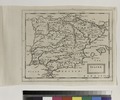
Spaine. NYPL1503415.tiff 6,299 × 5,248; 94.6 MB
-
Tercera, islands; Canary, islands; Islands of Cape Verd. NYPL1503450.tiff 8,080 × 7,812; 180.61 MB
-
The Molucca Isles; Isles of Japan; The Philippine Islands. NYPL1503445.tiff 5,248 × 6,299; 94.6 MB
-
The world in planisphere. NYPL1503411.tiff 6,299 × 5,248; 94.6 MB
-
Title page, vol. 1 NYPL1503409.tiff 5,248 × 6,299; 94.6 MB
-
Title page, vol. 2 NYPL1503410.tiff 4,624 × 6,299; 83.35 MB
-
Transilvania, Walachia, Moldavia, Bulgaria, Bessarab. NYPL1503428.tiff 6,299 × 5,248; 94.6 MB
-
Turquie in Asia. NYPL1503439.tiff 6,299 × 5,248; 94.6 MB
-
Turquie in Europe. NYPL1503429.tiff 5,739 × 5,248; 86.19 MB
-
Valmieras apkaimes pamatkarte – 1681. gads..jpg 434 × 640; 250 KB
-
Virginia. NYPL430368.tiff 5,248 × 6,299; 94.6 MB
-
Vischers Kriegskarte der Steiermark.jpg 3,543 × 3,170; 7.12 MB
-
Zanguebar. NYPL1503452.tiff 5,072 × 6,299; 91.43 MB


