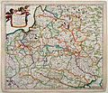
Category:1680s maps of Grand Duchy of Lithuania
Jump to navigation
Jump to search
Media in category "1680s maps of Grand Duchy of Lithuania"
The following 5 files are in this category, out of 5 total.
-
XSanson1683.jpg 1,387 × 1,038; 892 KB
-
Polen, Litouwen (full margins v2)- Danckerts, 1684.jpg 2,870 × 2,456; 1.46 MB
-
Magnus Ducat Lithuaniae and Rus Alba(Belarus).jpg 4,087 × 2,012; 4.66 MB
-
Magnus Ducate Lithuania & Rus Alba(Belarus).png 1,964 × 1,018; 855 KB


