Category:1672 maps
Jump to navigation
Jump to search
| ← · 1670 · 1671 · 1672 · 1673 · 1674 · 1675 · 1676 · 1677 · 1678 · 1679 · → |
Deutsch: Karten mit Bezug zum Jahr 1672
English: Maps related to the year 1672
Español: Mapas relativos al año 1672
Français : Cartes concernant l’an 1672
Русский: Карты 1672 года
Subcategories
This category has the following 6 subcategories, out of 6 total.
Media in category "1672 maps"
The following 62 files are in this category, out of 62 total.
-
01 Chardin Ponti euxini cum regionibus versus sptentrionem et orientem a.jpg 3,448 × 2,008; 1.33 MB
-
01 Chardin Ponti euxini cum regionibus versus sptentrionem et orientem b.jpg 4,640 × 2,888; 2.82 MB
-
05 Chardin Yerevan1672.gif 5,870 × 3,060; 5.7 MB
-
A chart of the Caribe islands (8429866373).jpg 800 × 684; 127 KB
-
Adel im Wandel76.jpg 2,123 × 1,457; 1,014 KB
-
Attersee-gbvischer-17jahrhundert.JPG 1,873 × 1,525; 988 KB
-
Bodensee Karte Merian 1672.jpg 2,362 × 1,420; 895 KB
-
Caspian Sea (Olfert Dapper).jpg 859 × 742; 291 KB
-
Cust van Hollant tusschen de Maes ende Texel. NYPL1619026.tiff 7,230 × 5,428; 112.28 MB
-
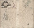
De cust van Barbaria, Gualata, Arguyn, en Geneheo, van Capo Verde. NYPL1619039.tiff 7,230 × 5,428; 112.28 MB
-
De zee-atlas ofte water-wereld ... (Title page) NYPL1619019.tiff 4,072 × 4,072; 47.46 MB
-
Het Canaal tusschen Engeland en Vrancrijck. NYPL1619032.tiff 7,230 × 5,428; 112.28 MB
-
Jacob van Meurs, Amoy and Quemoy (FL46961857 2473959).jpg 8,811 × 7,232; 92.69 MB
-
Johannes Buno, Hodiernae Belgicae sive Germaniae Inferioris Tabula (FL35076930 2586396).jpg 7,260 × 5,625; 56.29 MB
-
Karte Monumenta Paderbornensia - Ausschnitt Hoevelhof.jpg 1,137 × 850; 978 KB
-
Monumenta Paderbornensia-Karte-1.jpeg 3,144 × 2,144; 1.84 MB
-
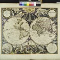
Nieuwe Werelt kaert. NYPL1619020.tiff 4,072 × 4,072; 47.45 MB
-
Noordtoost cust van Asia, van Japan tot Nova Zemla. NYPL1619046.tiff 7,230 × 5,428; 112.28 MB
-
Novissima totius terrarum orbis tabula (8429866155).jpg 800 × 706; 172 KB
-
Nowel Amsterdam en Lameriqve - 1672 LOC 2002623791.jpg 5,035 × 3,497; 4.27 MB
-
Nowel Amsterdam en Lameriqve - 1672 LOC 2002623791.tif 5,035 × 3,497; 50.38 MB
-
Pascaart van de Noord Zee, van Texel tot de Hoofden. NYPL1619025.tiff 7,230 × 5,428; 112.28 MB
-
Pascaart van Europa, als mede een gedeelt vande cust van Africa (7537866978).jpg 2,000 × 1,727; 3.42 MB
-
Pascaart van Europa. NYPL1619021.tiff 7,230 × 5,428; 112.28 MB
-
Pascaarte van de Zuyder-zee. NYPL1619024.tiff 7,230 × 5,428; 112.28 MB
-
Pascaert vande Caribes Eylanden (7537870398).jpg 2,000 × 1,730; 3.43 MB
-
Pascaerte van Nova Hispania, Chili, Peru, en Guatimala (7537871500).jpg 2,000 × 1,705; 3.37 MB
-
Pascaerte van Westindien de Vaste Kusten en de Eylanden (7537870062).jpg 2,000 × 1,732; 3.59 MB
-
Paskaerte van't oostelijckste der Middelandsche Zee. NYPL1619038.tiff 7,230 × 5,428; 112.28 MB
-
Pieter Goos - Nieuwe werelt kaert (New Map of the World).jpg 5,573 × 4,648; 8.75 MB


