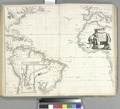
Category:1670s maps of the Atlantic Ocean
Jump to navigation
Jump to search
Media in category "1670s maps of the Atlantic Ocean"
The following 14 files are in this category, out of 14 total.
-
Nova Europa; Pascaarte de Hugo Allardt (1670).jpg 8,036 × 6,498; 7.77 MB
-
Pascaarte van alle de Zee-custen van Europa de Willem, Pieter e Joan Blaeu (1677).jpg 10,742 × 8,668; 75.29 MB
-
A general chart of the West India's RMG F8076.tiff 4,701 × 3,844; 51.7 MB
-
Pascaart van Europa (NYPL b13908778-1619021).jpg 5,418 × 4,512; 6.59 MB


