Category:1660s maps of China
Jump to navigation
Jump to search
Subcategories
This category has the following 2 subcategories, out of 2 total.
Media in category "1660s maps of China"
The following 6 files are in this category, out of 6 total.
-
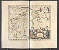
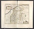
Golfe du Tonkin - Joan Blaeu - btv1b59056646 (1 of 2).jpg 12,096 × 9,440; 17.08 MB
-
Macao 1668 Joan Blaeu 05003 BnF.jpg 4,912 × 3,264; 4.59 MB
-
Map of China during Seaban of China (1661).svg 512 × 387; 242 KB


