
Category:1650s maps of Palestine
Subcategories
This category has the following 2 subcategories, out of 2 total.
Media in category "1650s maps of Palestine"
The following 23 files are in this category, out of 23 total.
-
 Palestina, siue Terræ Sanctæ descriptio LOC 2005625327.jpg 6,876 × 5,421; 6.84 MB
-
 Palestina, siue Terræ Sanctæ descriptio LOC 2005625327.tif 6,876 × 5,421; 106.64 MB
-
 A-3-37-70-Holy-Roman-Empire.jpg 3,000 × 2,198; 784 KB
-
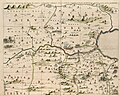
 1655 Samaria map by Conrad Buno.jpg 2,522 × 2,104; 1.77 MB
-
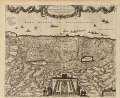
 Sourie ou Terre Saincte moderne - par Phi. de La Rue... - btv1b53179347p (1 of 2).jpg 6,964 × 5,206; 4.61 MB
-
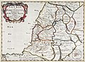
 Het Beloofde Land (22917584915).jpg 5,000 × 3,380; 4.19 MB
-
 Atlas Van der Hagen-KW1049B13 008-TERRA SANCTAE SIVE PROMISSIONIS, olim PALESTINA.jpeg 5,500 × 4,592; 4.2 MB
-
 Map - Special Collections University of Amsterdam - OTM- HB-KZL 33.09.42.tif 7,296 × 6,393; 133.45 MB
-

-
-

-
 Conrad Buno00a. The Geographer.jpg 2,222 × 400; 335 KB
-

-
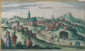
 Nazareth 1657.jpg 2,398 × 1,458; 1.55 MB
-
 Nazareth, by Jansson.png 2,326 × 1,388; 6.18 MB
-
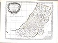
 Nicolas Sanson. Iudæa. 1653.jpg 13,567 × 15,022; 10.39 MB
-
 Ramma (Ramla) 1657.jpg 2,472 × 1,517; 1.47 MB
-
 Sourie Ou Terre Saincte Moderne, Philippe de La Rue.jpg 10,390 × 7,594; 23.93 MB
-

-
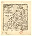
 Tribes of Israel 1658.jpg 2,483 × 1,995; 2.13 MB
-
 Tribus Aser.jpg 2,809 × 1,740; 1.99 MB
-
 Tribus Simeon 1658.jpg 2,487 × 1,896; 2.23 MB
-


.jpg)
.jpg)


.jpg)


_1657.jpg)

,_Recently_Depicted_and_Published_WDL210.png)


