Category:1640s maps of Finland
Jump to navigation
Jump to search
Media in category "1640s maps of Finland"
The following 5 files are in this category, out of 5 total.
-
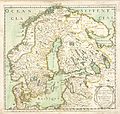
 Blaeu 1645 - Suecia Dania et Norvegia regna Europæ septentrionolia-2010-04-12.JPG 3,129 × 2,505; 1.83 MB
-
 Blaeu 1645 - Suecia Dania et Norvegia regna Europæ septentrionolia.jpg 3,619 × 3,012; 1.66 MB
-
 1646 Sveciæ &c Janssonius.jpg 4,953 × 4,233; 19.78 MB
-
 La Scandinavie et … - no-nb krt 00477.jpg 4,126 × 3,934; 5.7 MB
-
 Mvstarinda.jpg 817 × 861; 250 KB


