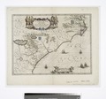
Category:1630s maps of Virginia
Jump to navigation
Jump to search
States of the United States: Delaware · Florida · Massachusetts · New Jersey · New York · Pennsylvania · Virginia
Puerto Rico
Puerto Rico
Media in category "1630s maps of Virginia"
The following 9 files are in this category, out of 9 total.
-
Section of Champlain's Map.png 1,068 × 760; 1.02 MB
-
Atlas ou Representation du Monde Universel t. 2. 1633 (110103027).jpg 17,118 × 12,159; 37.05 MB
-
Nova Anglia, Novum Belgium, et Virginia - Johannes Janssonius, excudit. NYPL1222651.tiff 5,451 × 4,896; 76.36 MB
-
Nova Anglia, Novum Belgium, et Virginia. NYPL464984.tiff 4,874 × 4,233; 59.03 MB
-
Nova Anglia Novum Belgium et Virginia (8431021382).jpg 800 × 689; 113 KB
-
Nova Virginiae tabvla. NYPL434464.tiff 4,147 × 3,228; 38.3 MB


