Category:1613 maps
Jump to navigation
Jump to search
| ← · 1610 · 1611 · 1612 · 1613 · 1614 · 1615 · 1616 · 1617 · 1618 · 1619 · → |
Deutsch: Karten mit Bezug zum Jahr 1613
English: Maps related to the year 1613
Español: Mapas relativos al año 1613
Français : Cartes concernant l’an 1613
Русский: Карты 1613 года
Subcategories
This category has the following 3 subcategories, out of 3 total.
Media in category "1613 maps"
The following 10 files are in this category, out of 10 total.
-
Buildings on Saint Croix Island - circa 1613 - Project Gutenberg etext 20110.jpg 1,537 × 1,181; 2.25 MB
-
Burgauer Landtafel 1613 Ausschnitt Glöttweng Landensberg.jpg 866 × 697; 174 KB
-
K2godun.jpg 1,647 × 1,300; 3.03 MB
-
Kyivstar vkraina 1613 2.jpg 1,800 × 4,028; 4.42 MB
-
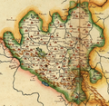
Il Contado di Molise nel Seicento.png 3,622 × 3,528; 16.98 MB
-
Willem Blaeu, Magni Ducatus Lithuaniae (FL36379331 2606047).jpg 18,275 × 19,240; 499.81 MB
-
Île sainte croix.png 2,323 × 1,740; 3.03 MB
-
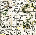
Богушевичи 1613 г..jpg 503 × 491; 81 KB


