Category:1608 maps of Europe
Jump to navigation
Jump to search
English: 1608 maps of Europe
Español: Mapas de Europa en 1608
Suomi: Euroopan kartat vuodelta 1608
Română: Hărți ale Europei din 1608
Subcategories
This category has the following 2 subcategories, out of 2 total.
I
U
- 1608 maps of Ukraine (empty)
Media in category "1608 maps of Europe"
The following 6 files are in this category, out of 6 total.
-
 2021 — Erste Julireise Mateus2019 — Batch (435).jpg 3,648 × 2,736; 3.22 MB
-
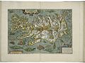 Map of Iceland by Abraham Ortelius.jpeg 1,595 × 1,184; 577 KB
-
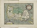 Map of Ireland 1 by Abraham Ortelius.jpeg 3,063 × 2,334; 2.32 MB
-
 Map of Prussia by Abraham Ortelius.jpeg 1,580 × 1,188; 622 KB
-
 Maps of Denmark and of the Cimbrian (Jutland) Peninsula by Abraham Ortelius.jpeg 3,071 × 2,343; 2.28 MB
-
 Romani Imperii Imago by Abraham Ortelius.jpg 13,498 × 9,976; 36.1 MB
.jpg)


_Peninsula_by_Abraham_Ortelius.jpeg)
