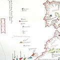
Category:15th-century maps of the Atlantic Ocean
Jump to navigation
Jump to search
Subcategories
This category has the following 7 subcategories, out of 7 total.
1
T
- Toscanelli map (8 F)
Media in category "15th-century maps of the Atlantic Ocean"
The following 6 files are in this category, out of 6 total.
-
Carte de Toscanelli.jpg 714 × 379; 142 KB
-
200 of 'Sea Pictures, drawn with pen and pencil' (11153911746).jpg 1,573 × 2,372; 679 KB
-
Facsimile of the Columbus Mappa Mundi.jpg 14,587 × 8,407; 19.48 MB
-
Pareto 1455.jpg 486 × 486; 192 KB


