Category:15th-century maps of Crete
Jump to navigation
Jump to search
- Regions of Greece
- Crete
Media in category "15th-century maps of Crete"
The following 12 files are in this category, out of 12 total.
-
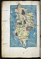
 I Creta - Buondelmonti Cristoforo - 1420.jpg 583 × 788; 179 KB
-
 Liber insularum Arcipelagi (Cotton MS Vespasian a.XIII.art.1, f.9v) image.jpg 4,027 × 5,707; 16.24 MB
-
 Liber insularum Arcipelagi (Cotton MS Vespasian a.XIII.art.1, f.9v).jpeg 4,989 × 6,561; 37.49 MB
-
 Crete RMG F1554.tiff 4,865 × 6,922; 96.35 MB
-
 Liber Insularum Cycladum (Arundel MS 93.art.7, f.134v).jpeg 5,655 × 8,078; 58.39 MB
-
 Brooklyn Museum - Map The Central Mediterranean.jpg 768 × 594; 74 KB
-
 Brooklyn Museum - Map The Eastern Mediterranean.jpg 768 × 569; 78 KB
-

-

-
 Map of Crete - Sonetti Bartolommeo Dalli - 1485.jpg 2,176 × 1,500; 638 KB
-
 "Creta" (23284176062).jpg 4,922 × 3,409; 1.26 MB
-


_image.jpg)
.jpeg)
.jpeg)


_with_buildings,_river_and_ships_at_sea.jpg)
.jpg)

.jpg)
.jpeg)