
Category:1589 maps
| ← · 1580 · 1581 · 1582 · 1583 · 1584 · 1585 · 1586 · 1587 · 1588 · 1589 · → |
Deutsch: Karten mit Bezug zum Jahr 1589
English: Maps related to the year 1589
Español: Mapas relativos al año 1589
Français : Cartes concernant l’an 1589
Русский: Карты 1589 года
Subcategories
This category has the following 3 subcategories, out of 3 total.
E
Media in category "1589 maps"
The following 24 files are in this category, out of 24 total.
-
 (La Coruña. El Ferrol, Spain) LOC 2004629171.jpg 6,295 × 4,950; 4.49 MB
-
 (La Coruña. El Ferrol, Spain) LOC 2004629171.tif 6,295 × 4,950; 89.15 MB
-
 1589 Totius Orbis de Jode.jpg 3,080 × 2,152; 1.47 MB
-
 CEM-11-Chinae-nova-descriptio-2521.jpg 1,770 × 1,400; 3.3 MB
-
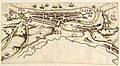 Dieppe 1589.jpg 1,460 × 800; 429 KB
-

-
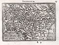 Illyricum. Slavoniae, Croatiae, Carniae, Istriae, Bosniae descr. 1589.jpg 1,411 × 1,086; 690 KB
-
 Jagdgrenze Hohenlohe Berlichingen und Brandenburg-Ansbach.jpg 3,845 × 2,536; 669 KB
-
 La Coruña. El Ferrol, Spain LOC 2004629169.jpg 8,520 × 6,207; 9.39 MB
-
 La Coruña. El Ferrol, Spain LOC 2004629169.tif 8,520 × 6,207; 151.3 MB
-
 Lismore RMG F2033.tiff 6,318 × 5,606; 101.33 MB
-
 Ortelius Maris Pacifici 1589 UTA.jpg 1,388 × 950; 619 KB
-
 Ortelius - Maris Pacifici 1589.jpg 4,001 × 2,771; 3.81 MB
-
 Paolo Forlani, La nvova et esatta descrittione della Soria, e della Terra Santa (FL62290845 2368572).jpg 17,610 × 13,020; 244.67 MB
-

-

-
 Terrestrial table globe RMG D7845 4.jpg 1,944 × 1,280; 1.47 MB
-
 Territorio di Perugia 1589, Ignazio Danti.jpg 650 × 491; 154 KB
-

-

-

-
 Typus Orbis Terrarum Iodocus Hondius fecit 1589 RMG S0162.jpg 1,280 × 949; 749 KB
-
 Typvs orbis terrarvm LOC 87690700.jpg 2,849 × 2,369; 374 KB
-
 Typvs orbis terrarvm LOC 87690700.tif 2,849 × 2,369; 19.31 MB
_LOC_2004629171.jpg)


.jpg)
_-_Gallica.jpg)


