Category:1570s maps of the Ottoman Empire
Jump to navigation
Jump to search
Subcategories
This category has the following 8 subcategories, out of 8 total.
Media in category "1570s maps of the Ottoman Empire"
The following 6 files are in this category, out of 6 total.
-
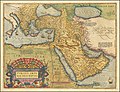 Turcici Imperii Descriptio.jpg 12,501 × 9,576; 29.54 MB
-
 Ca. 1576 map - Europe, the Ottoman Empire and Persia.jpg 2,222 × 1,600; 1.06 MB
-
-
 Sambucus Map of Hungary 1578.jpeg 3,000 × 2,088; 3.15 MB
-
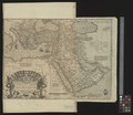
 Atlas Ortelius KB PPN369376781-088av-088br.jpg 3,000 × 2,194; 4.73 MB
-
 UBBasel Map 1570-1579 Kartenslg Mappe 250-1.tif 9,733 × 8,454, 2 pages; 235.44 MB


.K.jpg)

