Category:1570s maps of Eastern Europe
Jump to navigation
Jump to search
Media in category "1570s maps of Eastern Europe"
The following 10 files are in this category, out of 10 total.
-
 1570-Poloniae Lituaniae-Rus.jpg 5,252 × 4,156; 4.4 MB
-
 De Regno et tota regione Poloniae, S. Münster, Cosmographia universalis.png 1,845 × 1,465; 1.3 MB
-
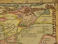
 Litvania map 1570.png 764 × 593; 1.02 MB
-
 De Regno et tota regione Poloniae Cosmographia Universalis.png 2,337 × 3,805; 3.12 MB
-
 Moschovia Nuova Tavola northeast.jpg 800 × 600; 116 KB
-
 Moschovia Nuova Tavola northwest.jpg 800 × 600; 123 KB
-
 Moschovia Nuova Tavola southeast.jpg 800 × 600; 113 KB
-
 Moschovia Nuova Tavola southwest.jpg 800 × 600; 122 KB
-

-
 Moschovia Nuova Tavola.jpg 800 × 600; 128 KB


