Category:1569 maps of Europe
Jump to navigation
Jump to search
English: 1569 maps of Europe
Español: Mapas de Europa en 1569
Suomi: Euroopan kartat vuodelta 1569
Română: Hărți ale Europei din 1569
Subcategories
This category has the following 2 subcategories, out of 2 total.
G
- 1569 maps of Germany (2 F)
Media in category "1569 maps of Europe"
The following 8 files are in this category, out of 8 total.
-
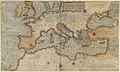 1569 map of the Mediterranean Sea.jpg 9,953 × 5,973; 9.41 MB
-

-
 Gerard Mercator's 1569 map of the world - Sheet 04.tif 10,930 × 8,370; 261.76 MB
-
 Gerard Mercator's 1569 map of the world - Sheet 10.tif 10,937 × 8,376; 262.12 MB
-

-
 Lokeren 1569.png 1,924 × 1,500; 1.44 MB
-
 Mercator 1569 world map sheet 10.PNG 1,352 × 1,869; 923 KB
-
 UBBasel Map Griechenland Ägäis 1569 Kartenslg Mappe 250-30d.tif 11,012 × 8,612, 2 pages; 271.35 MB


