Category:1550 maps
Jump to navigation
Jump to search
| ← · 1550 · 1551 · 1552 · 1553 · 1554 · 1555 · 1556 · 1557 · 1558 · 1559 · → |
Deutsch: Karten mit Bezug zum Jahr 1550
English: Maps related to the year 1550
Español: Mapas relativos al año 1550
Français : Cartes concernant l’an 1550
Русский: Карты 1550 года
Subcategories
This category has the following 4 subcategories, out of 4 total.
Media in category "1550 maps"
The following 47 files are in this category, out of 47 total.
-
AFillesRepenties.jpg 654 × 768; 123 KB
-
Ancient world (FL13730364 2719745).jpg 2,730 × 2,235; 8.12 MB
-
Asia oceania anonymous c1550.jpg 1,113 × 579; 228 KB
-
Battista Agnese. Black Sea. HM 10. PORTOLAN ATLAS Italy, ca. 1550.A.jpg 4,884 × 3,384; 4.72 MB
-
Bohemiae Nova Descriptio Tabula (FL36554683 2525717).jpg 9,434 × 7,785; 108.05 MB
-
Carte de Sigüenza.jpg 2,760 × 1,985; 1.95 MB
-
Castilla del Oro.jpg 600 × 457; 69 KB
-
Die neuwen Inseln, so hinder Hispanien gegen Orient bey dem land India ligen. LOC 2005630224.tif 4,483 × 3,470; 44.51 MB
-
Mapa portolano de Jaume Olives (1550).jpg 9,477 × 7,011; 10.45 MB
-
MBA DSC 8558 DxO (11).jpg 2,873 × 2,255; 8.52 MB
-
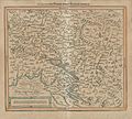
Muenster - Kranjska z Istro, Gorisko, Furlanijo.jpg 1,608 × 1,493; 866 KB
-
Münster Typus Orbis Universalis 1550 UTA.jpg 4,525 × 3,367; 3.25 MB
-
Nuovo et verissimo ritratto del isola di Malta (FL13722433 2471713).jpg 11,251 × 8,988; 142.86 MB
-
Plan scenographique Lyon-Antiquaille.JPG 850 × 490; 189 KB
-
Portolan chart of the Mediterranean and connecting seas. LOC 2010588182.jpg 3,975 × 8,615; 3.34 MB
-
Portolan chart of the Mediterranean and connecting seas. LOC 2010588182.tif 3,975 × 8,615; 97.97 MB
-
Sardinia (FL83240461 2589197).jpg 2,503 × 3,953; 9.64 MB
-
Sclauonia oder Windisch Marck, Bossen, Crabaten 1550.jpg 2,324 × 2,095; 888 KB
-
Sebastian Munster map Carniola.png 869 × 795; 1.71 MB
-
Sebastian Münster, Acon siue Aca, quae & Ptolemais (FL169642132 2370313).jpg 3,207 × 5,382; 13.46 MB
-
Sebastian Münster, Edinburgh (FL25571401 3816674).jpg 4,584 × 2,931; 21.37 MB
-
Sebastian Münster, Elba (FL83240490 2589405).jpg 5,804 × 8,717; 58.37 MB
-
Sebastian Münster, Greece (FL35069277 2527893).jpg 5,180 × 7,615; 52.43 MB
-
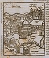
Sebastian Münster, Ierusalem (FL6881304 2368136).jpg 800 × 951; 579 KB
-
Sebastian Münster, L'isle de Cypre (FL35601234 2566221).jpg 4,930 × 7,457; 49.9 MB
-
Sebastian Münster, La description d'Egypte tresflorissan-teregion (FL25570615 2502152).jpg 5,078 × 7,499; 49.01 MB
-
Sebastian Münster, Neapolis (FL168327126 2370314).jpg 2,006 × 1,603; 3.08 MB
-
Sebastian Münster, Palestine (FL200255410 2368810).jpg 2,884 × 4,522; 7.28 MB
-
Sebastian Münster, Palestine (FL6880856 2368809).jpg 2,000 × 3,135; 3.04 MB
-
Sebastian Münster, Rubeacuum Rufach (FL167448922 2370377).jpg 11,024 × 7,601; 91.41 MB
-
Sebastian Münster, Syria (FL200255396 2368807).jpg 2,576 × 2,314; 3.25 MB
-
Sebastian Münster, Tartaria, Sarmatia Asiatica (FL36380553 2614081).jpg 4,244 × 6,458; 41.42 MB
-
Terrestrial table globe RMG D8043 2.jpg 1,280 × 854; 561 KB
-
Typus orbis universalis, Sebastian Munster 1550.jpg 1,778 × 1,278; 2.17 MB
-
Typus orbis universalis. LOC 84696976.jpg 4,628 × 3,764; 3.24 MB
-
Typus orbis universalis. LOC 84696976.tif 4,628 × 3,764; 49.84 MB
-
UBBasel Map 1550 Kartenslg Mappe 237-1 Britannische Inseln (cropped).tiff 2,832 × 1,889; 15.33 MB
-
UBBasel Map 1550 Kartenslg Mappe 237-1 Britannische Inseln.tiff 4,234 × 4,113, 2 pages; 49.85 MB


