Category:Église Saints-Pierre-et-Paul (Asselborn)
Jump to navigation
Jump to search
| Object location | | View all coordinates using: OpenStreetMap |
|---|
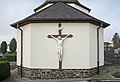
church in Asselborn, Luxembourg  | |||||
| Upload media | |||||
| Instance of | |||||
|---|---|---|---|---|---|
| Dedicated to | |||||
| Location | Asselborn, Wincrange, Canton of Clervaux, Luxembourg | ||||
 | |||||
Media in category "Église Saints-Pierre-et-Paul (Asselborn)"
The following 4 files are in this category, out of 4 total.
-
 Aasselbuer Kierch.JPG 2,682 × 3,870; 5.9 MB
-
 Kirche Asselborn 01.jpg 2,820 × 1,670; 3.15 MB
-
 Kirche Asselborn 02.jpg 2,627 × 1,800; 3.98 MB
-
 Kirche Asselborn 03.jpg 1,735 × 2,720; 4.34 MB


