Category:Église Saint-Pie X (Luxembourg-Belair)
Jump to navigation
Jump to search
| Object location | | View all coordinates using: OpenStreetMap |
|---|
church building in Luxembourg  | |||||
| Upload media | |||||
| Instance of | |||||
|---|---|---|---|---|---|
| Location |
| ||||
 | |||||
Subcategories
This category has only the following subcategory.
Media in category "Église Saint-Pie X (Luxembourg-Belair)"
The following 8 files are in this category, out of 8 total.
-
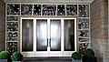 Kierch Lux Belair entreeA.jpg 4,119 × 2,317; 2.29 MB
-
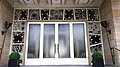 Kierch Lux Belair entreeB.jpg 4,113 × 2,313; 2.14 MB
-
 Kierch Lux Belair Tuerm.jpg 2,307 × 4,101; 1.37 MB
-
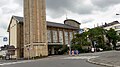
 Kierch Lux Belair.jpg 2,322 × 4,128; 2.43 MB
-
 Kierch Lux Belair2.jpg 3,829 × 2,153; 1.58 MB
-
 Kierch Lux Belair3.jpg 4,128 × 2,322; 4.4 MB
-
 Weekräiz Lux Belair Patio.jpg 4,128 × 2,322; 5.66 MB
-
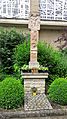 Weekräiz Lux Belair.jpg 2,315 × 4,115; 3.25 MB


