Category:Église Saint-Celse (Reichlange)
Jump to navigation
Jump to search
| Object location | | View all coordinates using: OpenStreetMap |
|---|
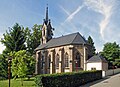
church building in Luxembourg  | |||||
| Upload media | |||||
| Instance of | |||||
|---|---|---|---|---|---|
| Location |
| ||||
 | |||||
Media in category "Église Saint-Celse (Reichlange)"
The following 4 files are in this category, out of 4 total.
-
 KierRai1.JPG 1,755 × 2,239; 587 KB
-
 Kirche Reichlange 01.jpg 1,960 × 1,427; 2.42 MB
-
 Kirche Reichlange 02.jpg 1,341 × 2,085; 2.32 MB
-
 Kirche Reichlange 03.jpg 1,400 × 2,000; 2.51 MB


