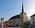
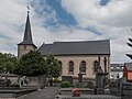
Category:Église Saint-Bernard (Niederpallen)
Jump to navigation
Jump to search
| Object location | | View all coordinates using: OpenStreetMap |
|---|
church building in Luxembourg  | |||||
| Upload media | |||||
| Instance of | |||||
|---|---|---|---|---|---|
| Location |
| ||||
 | |||||
Media in category "Église Saint-Bernard (Niederpallen)"
The following 4 files are in this category, out of 4 total.
-
 Kirche Niederpallen 01.jpg 1,925 × 1,453; 1.66 MB
-
 Kirche Niederpallen 02.jpg 1,870 × 1,495; 1.37 MB
-
 Niederpallen rue de Reichlange, rue de Noerdange 01.jpg 2,083 × 1,345; 1.91 MB
-
 Niederpallen, église Saint-Bernard foto4 2014-06-14 12.39.jpg 4,397 × 3,298; 6.94 MB


