Category:Álava-Araba in the 1910s
Jump to navigation
Jump to search
Provinces of Spain: Álava · Asturias‡ · Barcelona · Biscay · Burgos · Cáceres · Cantabria‡ · Cuenca · Gipuzkoa · Guadalajara · Madrid‡ · Murcia‡ · Navarre‡ · Segovia · Toledo · Valencia · Autonomous cities: Ceuta · Melilla
‡: uniprovincial autonomous communities.
‡: uniprovincial autonomous communities.

Español: Álava-Araba en la década de los 1910s.
Français : Álava-Araba (Espagne) dans les années 1910s.
Subcategories
This category has the following 4 subcategories, out of 4 total.
- 1915 in Álava-Araba (empty)
V
Media in category "Álava-Araba in the 1910s"
The following 200 files are in this category, out of 356 total.
(previous page) (next page)-
Acebedo (GGPVN p.612).jpg 1,060 × 668; 321 KB
-
Alegría de Álava (GGPVN p.361).jpg 2,032 × 584; 310 KB
-
Alegría de Álava. Casa ayuntamiento (GGPVN p.363).jpg 1,552 × 1,308; 242 KB
-
Alegría de Álava. La iglesia parroquial (GGPVN p.365).jpg 848 × 1,904; 157 KB
-
Alegría de Álava. Ruinas de la capilla de Nuestra Señora de Henayo (GGPVN p.367).jpg 1,092 × 1,152; 174 KB
-
Aloria (GGPVN p.561).jpg 1,544 × 624; 117 KB
-
Alrededores de Marquínez (GGPVN p.67).jpg 1,516 × 668; 121 KB
-
Alrededores de Marquínez (GGPVN p.68).jpg 1,548 × 986; 549 KB
-
Amurrio (GGPVN p.551).jpg 2,370 × 777; 733 KB
-
Amurrio. Escuelas públicas y casa consistorial (GGPVN p.552).jpg 1,560 × 636; 133 KB
-
Amurrio. Grupo de chalets en la carretera (GGPVN p.550).jpg 1,545 × 704; 474 KB
-
Amurrio. Iglesia parroquial (GGPVN p.552).jpg 1,537 × 827; 530 KB
-
Amurrio. Peña Salvada (1183 metros de elevación) (GGPVN p.36).jpg 1,018 × 582; 150 KB
-
Amurrio. Puerta de la iglesia parroquial (GGPVN p.553).jpg 1,536 × 1,308; 244 KB
-
Amárita. Ganado vacuno de la raza Schwitz.jpg 1,544 × 1,048; 241 KB
-
Antezana de Álava. Iglesia parroquial de San Miguel (GGPVN p.436).jpg 1,533 × 957; 647 KB
-
Antoñana (GGPVN p.369).jpg 1,560 × 988; 198 KB
-
Anúcita (GGPVN p.481).jpg 1,556 × 888; 165 KB
-
Apellániz (GGPVN p.371).jpg 2,128 × 672; 370 KB
-
Apodaca (GGPVN p.412).jpg 1,900 × 360; 231 KB
-
Aramayona. Carretera que cruza el valle (GGPVN p.373).jpg 2,140 × 816; 701 KB
-
Araya (GGPVN p.396).jpg 2,001 × 594; 547 KB
-
Araya. Castillo llamado de Morumendi (GGPVN p.397).jpg 832 × 940; 92 KB
-
Arbulo. Casa donde nació el Fuerte de Arbulo (GGPVN p.433).jpg 1,048 × 696; 85 KB
-
Arbulo. Parroquia de San Martín (GGPVN p.433).jpg 1,548 × 740; 119 KB
-
Arciniega (GGPVN p.555).jpg 2,076 × 784; 569 KB
-
Arciniega. Antiguo convento de Agustinas (GGPVN p.556).jpg 949 × 1,743; 682 KB
-
Arciniega. Torreón del palacio antiguo (GGPVN p.557).jpg 1,100 × 1,824; 224 KB
-
Armiñón. Palacio de los marqueses de Terán (GGPVN p.383).jpg 1,576 × 1,108; 196 KB
-
Armiñón. Parte de la villa bañada por el río Zadorra (GGPVN p.382).jpg 2,012 × 768; 606 KB
-
Arriola (GGPVN p.399).jpg 1,880 × 440; 218 KB
-
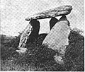
Arrízala. Dolmen Sorguineche (casa de las brujas) (GGPVN p.500).jpg 1,069 × 905; 446 KB
-
Arróyabe. La iglesia parroquial (GGPVN p.391).jpg 920 × 1,868; 195 KB
-
Artaza (GGPVN p.458).jpg 1,174 × 494; 279 KB
-
Artómaña (GGPVN p.562).jpg 1,552 × 508; 92 KB
-
Aránguiz (GGPVN p.436).jpg 1,075 × 698; 358 KB
-
Aríñez. La iglesia parroquial (GGPVN p.378).jpg 1,068 × 1,536; 160 KB
-
Aspuru (GGPVN p.515).jpg 2,343 × 573; 428 KB
-
Asteguieta (GGPVN p.438).jpg 1,068 × 540; 68 KB
-
Asteguieta. Casa solariega (GGPVN p.437).jpg 1,536 × 808; 138 KB
-
Astúlez (GGPVN p.612).jpg 1,092 × 1,196; 149 KB
-
Atauri (GGPVN p.388).jpg 1,572 × 1,508; 337 KB
-
Atauri. Exterior de una mina de asfalto (GGPVN p.49).jpg 1,544 × 1,332; 284 KB
-
Ayala. Lugar donde se celebraban las Juntas (GGPVN p.565).jpg 1,552 × 1,176; 179 KB
-
Ayuntamiento Labastida 1915.jpg 1,536 × 1,052; 175 KB
-
Azpuru. Altar de la iglesia parroquial (GGPVN p.514).jpg 1,548 × 2,336; 432 KB
-
Añes (GGPVN p.567).jpg 1,548 × 656; 134 KB
-
Añes. Escuelas públicas.jpg 1,512 × 628; 124 KB
-
Bachicabo (GGPVN p.613).jpg 1,067 × 732; 322 KB
-
Badaya. Ruinas del convento (GGPVN p.450).jpg 1,564 × 920; 210 KB
-
Barambio (GGPVN p.592).jpg 1,876 × 608; 425 KB
-
Barambio. Edificios de las minas (GGPVN p.594).jpg 2,024 × 680; 374 KB
-
Barrio (GGPVN p.614).jpg 1,065 × 789; 397 KB
-
Barriobusto 1915.jpg 1,515 × 837; 575 KB
-
Barrón (GGPVN p.459).jpg 1,156 × 468; 65 KB
-
Basabe (GGPVN p.614).jpg 1,536 × 842; 589 KB
-
Basílica Armentia 1915.jpg 908 × 684; 286 KB
-
Baños de Ebro 1915.jpg 1,888 × 704; 342 KB
-
Belunza. El poblado alrededor de la iglesia parroquial (GGPVN p.607).jpg 1,538 × 740; 273 KB
-
Berantevilla 1915.jpg 2,124 × 597; 447 KB
-
Berganzo 1915.jpg 1,550 × 994; 636 KB
-
Bergüenda. Iglesia parroquial (GGPVN p.585).jpg 1,548 × 956; 613 KB
-
Bergüenda. Puente sobre el río Omecillo (GGPVN p.584).jpg 1,544 × 1,080; 183 KB
-
Bocarrón de Zaragua (Entrada) (GGPVN p.80).jpg 836 × 764; 75 KB
-
Calle en Laguardia 1915.jpg 1,064 × 1,756; 474 KB
-
Campamento de los exploradores (GGPVN p.82).jpg 2,248 × 1,544; 933 KB
-
Capilla Virgen del Pilar Laguardia 1915.jpg 1,527 × 2,208; 1.8 MB
-
Caranca (GGPVN p.615).jpg 1,076 × 624; 84 KB
-
Carretera de Vitoria a Bilbao en Amézaga.jpg 2,344 × 714; 667 KB
-
Casa del Santo 1915.jpg 1,536 × 968; 197 KB
-
Casa Samaniego Laguardia 1915.jpg 1,076 × 932; 127 KB
-
Castillo de Ocio 1915.jpg 1,548 × 1,132; 252 KB
-
Castillo Portilla 1915.jpg 1,070 × 1,236; 387 KB
-
Cicujano. Iglesia parroquial (GGPVN p.461).jpg 1,548 × 952; 169 KB
-
Columna señalando el límite de Álava y Burgos en el lugar de Rivabellosa.jpg 1,998 × 975; 997 KB
-
Comunión (GGPVN p.491).jpg 1,530 × 925; 647 KB
-
Corres (GGPVN p.422).jpg 1,548 × 635; 407 KB
-
Corres. Fábrica de asfalto, primera en España (GGPVN p.424).jpg 1,528 × 620; 126 KB
-
Corres. La presa (GGPVN p.423).jpg 1,552 × 1,008; 158 KB
-
Cripán 1915.jpg 1,896 × 476; 258 KB
-
Cueva de Basocho (Interior) (GGPVN p.66).jpg 1,056 × 1,443; 758 KB
-
Cueva de Goro (Entrada) (GGPVN p.58).jpg 1,432 × 1,010; 387 KB
-
Cueva de Goro (Interior) (GGPVN p.60).jpg 1,416 × 971; 558 KB
-
Cueva de Guesal (Entrada) (GGPVN p.77).jpg 1,096 × 1,472; 242 KB
-
Cueva de Mairuelegorreta (entrada) (GGPVN p.86).jpg 1,552 × 1,168; 273 KB
-
Cueva de Mairuelegorreta (GGPVN p.93).jpg 1,068 × 1,464; 208 KB
-
Cueva de Mairuelegorreta. Capilla de Montserrat (GGPVN p.92).jpg 960 × 1,316; 172 KB
-
Cueva de Mairuelegorreta. Capillas de San José y de Santa María (GGPVN p.90).jpg 1,088 × 1,456; 193 KB
-
Cueva de Mairuelegorreta. Cortina oriental de 15 m. de largo por 6 de alto (GGPVN p.90).jpg 2,124 × 1,456; 1.24 MB
-
Cueva de Mairuelegorreta. Plaza de las capillas (GGPVN p.89).jpg 952 × 1,320; 150 KB
-
Cueva de Mairuelegorreta. Subida a la plaza de las Capillas (GGPVN p.87).jpg 1,076 × 1,516; 188 KB
-
Cueva de Obi (Interior) (GGPVN p.75).jpg 1,088 × 1,432; 211 KB
-
Cueva del Chopo (GGPVN p.81).jpg 856 × 852; 95 KB
-
Detalle Pórtico Armentia 1915.jpg 1,524 × 1,160; 247 KB
-
Dolmen Arrízala 1915.jpg 1,172 × 948; 545 KB
-
Dolmen Eguílaz 1915.jpg 1,556 × 1,024; 222 KB
-
Durana (GGPVN p.392).jpg 1,891 × 411; 329 KB
-
Durana. Carretera de Vitoria a Vergara (GGPVN p.393).jpg 1,548 × 1,084; 222 KB
-
Délica (GGPVN p.562).jpg 1,556 × 676; 121 KB
-
Echagüen (GGPVN p.413).jpg 1,516 × 652; 110 KB
-
Eguílaz. Dolmen en la finca de Aizcomendi (GGPVN p.516).jpg 1,496 × 1,076; 187 KB
-
El Burgo (GGPVN p.432).jpg 1,556 × 992; 175 KB
-
El río Nervión al atravesar el pueblo de Llodio (GGPVN p.21).jpg 1,540 × 700; 406 KB
-
El río Zadorra en Trespuentes (Iruña) (GGPVN p.27).jpg 1,560 × 1,116; 214 KB
-
El zadorra al juntarse con el Ebro en la frontera de Álava y Burgos (GGPVN p.8).jpg 1,560 × 1,064; 199 KB
-
Elciego 1915.jpg 1,556 × 580; 110 KB
-
Elguea (GGPVN p.404).jpg 1,560 × 748; 149 KB
-
Elosu. Iglesia parroquial (GGPVN p.532).jpg 1,531 × 657; 435 KB
-
Elvillar 1915.jpg 1,536 × 545; 350 KB
-
Empalme de carreteras en Oyón.jpg 2,176 × 732; 673 KB
-
Entrada al Condado de Treviño por el puerto de Vitoria.jpg 1,564 × 800; 143 KB
-
Entronque de carreteras en Villarreal (GGPVN p.137).jpg 2,164 × 856; 737 KB
-
Entronque de las carreteras a San Sebastián y Aelgría en término de Matauco.jpg 1,280 × 900; 142 KB
-
Eras de San Juan Salvatierra 1915.jpg 1,552 × 936; 209 KB
-
Erbi (GGPVN p.569).jpg 1,576 × 1,012; 180 KB
-
Escuela de artes y oficios, salón elíptico.jpg 1,522 × 1,128; 842 KB
-
Escuela Práctica Agricultura carro de transporte para la mies.jpg 1,532 × 955; 661 KB
-
Escuela Práctica de Agricultura desfonde.jpg 1,535 × 749; 526 KB
-
Escuela Práctica de Agricultura geodesia.jpg 1,536 × 708; 138 KB
-
Escuela Práctica de Agricultura segadora atadora.jpg 1,556 × 1,052; 216 KB
-
Escuela Práctica de Agricultura toro Schwitz.jpg 1,080 × 816; 125 KB
-
Escuela Práctica de Agricultura vacas.jpg 1,531 × 469; 343 KB
-
Esculturas Marquínez 1915.jpg 932 × 1,250; 566 KB
-
Espejo (GGPVN p.616).jpg 2,128 × 564; 316 KB
-
Estabillo (GGPVN p.384).jpg 2,008 × 524; 291 KB
-
Estabillo. Puerta de la iglesia parroquial (GGPVN p.385).jpg 1,088 × 1,748; 310 KB
-
Estarrona (GGPVN p.474).jpg 1,552 × 608; 114 KB
-
Fontecha (GGPVN p.586).jpg 1,540 × 516; 321 KB
-
Foronda. Iglesia de San Martín (GGPVN p.435).jpg 1,544 × 948; 169 KB
-
Gaceo (GGPVN p.455).jpg 2,103 × 564; 530 KB
-
Galarreta (GGPVN p.517).jpg 1,506 × 462; 177 KB
-
Gauna. Iglesia parroquial y plaza pública (GGPVN p.445).jpg 1,539 × 1,014; 663 KB
-
Gogénuri (GGPVN p.597).jpg 2,376 × 660; 375 KB
-
Gogénuri (Llodio). Iglesia parroquial y plaza de la Constitución (GGPVN p.598).jpg 1,536 × 1,060; 209 KB
-
Gogénuri. Antigua iglesia de Santa María del Yermo (vista por delante) (GGPVN p.599).jpg 1,528 × 1,084; 207 KB
-
Gopegui. Cruz de piedra (GGPVN p.414).jpg 1,064 × 1,402; 725 KB
-
Gopegui. Iglesia parroquial (GGPVN p.413).jpg 1,552 × 684; 111 KB
-
Gordoa (GGPVN p.400).jpg 1,872 × 500; 396 KB
-
Guardia foral o miñón alavés, con el uniforme de 1911 (GGPVN p.265).jpg 598 × 1,354; 328 KB
-
Guevara (GGPVN p.405).jpg 2,140 × 736; 592 KB
-
Guevara. Ruinas del castillo (GGPVN p.406).jpg 1,564 × 772; 155 KB
-
Guevara. Ruinas del palacio (GGPVN p.407).jpg 1,072 × 1,056; 146 KB
-
Gujuli (GGPVN p.608).jpg 1,544 × 392; 74 KB
-
Hereña (GGPVN p.483).jpg 1,424 × 780; 130 KB
-
Hereña. Puente del ferrocarril sobre el río Bayas (GGPVN p.127).jpg 2,352 × 1,008; 960 KB
-
Hueto de Arriba (GGPVN p.468).jpg 1,564 × 580; 102 KB
-
Hueto de Arriba. Cueva de Goro o de los Huetos (GGPVN p.59).jpg 1,060 × 1,700; 243 KB
-
Humilladero Zambrana 1915.jpg 1,088 × 1,144; 156 KB
-
Ibarra. Balneario (GGPVN p.375).jpg 1,544 × 1,084; 269 KB
-
Iglesia de Leza 1915.jpg 1,076 × 1,720; 213 KB
-
Iglesia de Zambrana 1915.jpg 1,568 × 980; 158 KB
-
Iglesia Elciego 1915.jpg 1,556 × 1,176; 201 KB
-
Iglesia Labastida 1915.jpg 1,528 × 1,294; 796 KB
-
Iglesia Portilla 1915.jpg 1,076 × 1,372; 561 KB
-
Iglesia Salinillas de Buradón 1915.jpg 1,552 × 1,140; 202 KB
-
Iglesia Santa Cruz del Fierro 1915.jpg 1,552 × 891; 569 KB
-
Iglesisa Labraza 1915.jpg 1,548 × 1,176; 205 KB
-
Incisiones en piedra (ATHA-BAR-NV-008-004).jpg 1,548 × 2,000; 1.95 MB
-
Irabien (GGPVN p.602).jpg 1,976 × 674; 532 KB
-
Irabien. Iglesia parroquial (GGPVN p.604).jpg 1,513 × 1,022; 631 KB
-
Irabien. Palacio de Lapuente (GGPVN p.603).jpg 1,534 × 1,087; 695 KB
-
Iruña. Capitel romano hallado en las excavaciones (GGPVN p.449).jpg 736 × 1,632; 138 KB
-
Iruña. Excavaciones y ruinas romanas (GGPVN p.447).jpg 1,530 × 1,090; 706 KB
-
Izarra (GGPVN p.606).jpg 2,116 × 456; 356 KB
-
Izoria (GGPVN p.570).jpg 1,540 × 340; 69 KB
-
Jáuregui (GGPVN p.456).jpg 1,540 × 690; 374 KB
-
Jáuregui. Iglesia de San Martín (GGPVN p.456).jpg 1,540 × 1,077; 717 KB
-
La frontera alavesa en los baños de Sobrón y Soportilla (GGPVN p.9).jpg 1,560 × 1,096; 217 KB
-
La Hoz (GGPVN p.623).jpg 1,552 × 852; 154 KB
-
La Lastra (GGPVN p.623).jpg 1,552 × 780; 129 KB
-
La Puebla de La Barca. Puente colgante sobre el Ebro (GGPVN p.23).jpg 1,548 × 900; 187 KB
-
Labastida 1915.jpg 2,116 × 528; 516 KB
-
Labraza 1915.jpg 1,884 × 594; 510 KB
-
Lacorzana. Desembocadura del río Ayuda en el Zadorra (GGPVN p.28).jpg 1,530 × 1,110; 775 KB
-
Lagrán 1915.jpg 2,360 × 468; 280 KB
-
Laguna de Otaza (GGPVN p.32).jpg 1,546 × 1,012; 704 KB
-
Lanciego 1915.jpg 2,105 × 741; 586 KB
-
Landa. Cantera de mármol negro (GGPVN p.51).jpg 1,544 × 1,096; 216 KB
-
Landa. Iglesia parroquial (GGPVN p.528).jpg 1,568 × 932; 201 KB
-
Larra. Ermita de San Bartolomé (GGPVN p.599).jpg 1,532 × 1,000; 206 KB
-
Leorza. Fábrica de asfaltos Maestu Leorza (GGPVN p.42).jpg 1,510 × 1,034; 760 KB
-
Letona (GGPVN p.415).jpg 1,872 × 372; 167 KB
-
Leza 1915.jpg 1,544 × 948; 389 KB
-
Lezama. Antiguo palacio de Larraco (GGPVN p.591).jpg 1,544 × 1,124; 185 KB
-
Lezama. Ventanal de la iglesia parroquial (GGPVN p.590).jpg 1,036 × 1,856; 223 KB
-
Llanteno. Escuelas públicas (GGPVN p.573).jpg 1,536 × 1,212; 198 KB
-
Llanura que se extiende entre La Guardia y la cordillera de Cantabria (GGPVN p.12).jpg 2,096 × 1,104; 606 KB
-
Los Zambolinos (Norte) (GGPVN p.80).jpg 844 × 848; 98 KB
-
Los Zambolinos (Sur) (GGPVN p.81).jpg 848 × 812; 93 KB
-
Luco (GGPVN p.530).jpg 1,515 × 423; 255 KB
-
Lujo (GGPVN p.570).jpg 1,900 × 508; 350 KB
-
Luyando. Balneario (GGPVN p.571).jpg 1,539 × 962; 662 KB
-
Luyando. Cruz donde se levantaba el árbol de Malato (GGPVN p.571).jpg 1,084 × 1,708; 179 KB
-
Luyando. Iglesia parroquial (GGPVN p.571).jpg 1,552 × 873; 362 KB


