2010 Baja California earthquake
Jump to navigation
Jump to search
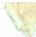
The 2010 Baja California Earthquake was an earthquake of 7.2 magnitude on the Moment magnitude scale that started 16 miles (26 km) south of Guadalupe Victoria, Mexico, at a depth of 20 miles (32 km).
-
USGS shake map of the Baja California earthquake
-
USGS shake map of the largest Baja California aftershock
-
USGS map showing within 10 minutes of the quake, PNG format
-
Map showing respondants who said they felt the quake
-
USGS map showing area of quake, approximately 2 hours after the quake
-
Location of quake within Mexico
-
map of Laguna Salada fault
See also
[edit]- WikiNews English: en:wikinews:7.2 quake rattles lower Colorado River area in Mexico
- WikiNews Espanol: es:Terremoto de 7,2 grados azota la zona del río Colorado, México
- WikiNews Deutsch: de:Erdbeben erschüttert amerikanisch-mexikanisches Grenzgebiet


