高岡市
Jump to navigation
Jump to search
city in Toyama Prefecture, Japan | |||||
| Upload media | |||||
| Instance of | |||||
|---|---|---|---|---|---|
| Location | Toyama Prefecture, Japan | ||||
| Located in or next to body of water | |||||
| Legislative body |
| ||||
| Head of government |
| ||||
| Legal form |
| ||||
| Inception |
| ||||
| Population |
| ||||
| Area |
| ||||
| Replaces |
| ||||
| Replaced by |
| ||||
| official website | |||||
 | |||||
English: Takaoka is a city in Toyama, Japan.
日本語: 高岡市は日本の富山県にある市。
Maps 地図
[edit]-
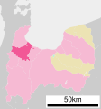
Location map of Takaoka
高岡市の位置図 -
Location map of Takaoka
高岡市の位置図
Symbols シンボル
[edit]-
Flag of Takaoka
高岡市旗 -
Symbol of Takaoka
高岡市章
Geography 地理
[edit]Aerial photographs 航空写真
[edit]-
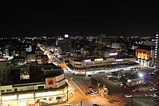
Aerial photograph of central Takaoka
高岡市中心部の航空写真
Mountains 山
[edit]-
Mount Futagami
二上山
Rivers 河川
[edit]-
Oyabe River
小矢部川
Coasts 海岸
[edit]-
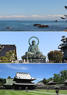
Amaharashi Coast
雨晴海岸
History 歴史
[edit]Castles 城
[edit]-
Takaoka Castle
高岡城 -
Kifune Castle
木舟城
Shrines 神社
[edit]-
Imizu Shrine
射水神社 -
Keta Shrine
気多神社 -
Takaoka Sekino Shrine
高岡関野神社 -
Futagami Imizu Shrine
二上射水神社 -
Fushiki Shrine
伏木神社 -
Nishibo Shrine
西保神社
Temples 寺院
[edit]-
Zuiryu-ji Temple
瑞龍寺 -
Shoko-ji Temple
勝興寺 -
Kokutai-ji Temple
国泰寺 -
Daibutsu-ji Temple
大佛寺 -
Tozen-in Temple
東漸院 -
Etchu Kokubun-ji Temple
越中国分寺
Culture 文化
[edit]Cuisine 料理
[edit]-
Takaoka Korokke
高岡コロッケ -
Takaoka Green Ramen
高岡グリーンラーメン
Festivals 祭り
[edit]-
Takaoka Mikurumayama Festival
高岡御車山祭 -
Takaoka Tanabata Festival
高岡七夕まつり -
Toide Tanabata Festival
戸出七夕まつり -
Fushiki Hikiyama Festival
伏木曳山祭
Famous place 名所
[edit]-
Takaoka Daibutsu
高岡大仏 -
Tomb of Maeda Toshinaga
前田利長墓所 -
Kanayamachi
金屋町 -
Yamachosuji
山町筋 -
Takaoka Kojo Park
高岡古城公園 -
Takaoka Kojo Park
高岡古城公園 -
Takaoka Kojo Park
高岡古城公園 -
Takaoka Kojo Park
高岡古城公園
Buildings 建物
[edit]Government offices 官公庁
[edit]-
Takaoka City Hall
高岡市役所 -
Takaoka Police Station
高岡警察署 -
Takaoka City Fire Department
高岡市消防本部
Office buildings オフィスビル
[edit]-
Toyama Bank Headquarters
富山銀行本店 -
Tonami Transportation Headquarters
トナミ運輸本社 -
Yomiuri Shimbun Hokuriku Branch
読売新聞北陸支社 -
Toyama Shimbun Takaoka Branch
富山新聞高岡支社
Commerce buildings 商業施設
[edit]-
AEON MALL Takaoka
イオンモール高岡 -
Takaoka Daiwa
高岡大和
Museums 博物館・美術館
[edit]-
Takaoka Municipal Museum
高岡市立博物館 -
Takaoka Art Museum
高岡市美術館 -
Fushiki Weather Station Museum
伏木気象資料館 -
Fushiki Kitamaebune Museum
伏木北前船資料館
Sports venues スポーツ施設
[edit]-
Takaoka Municipal Gymnasium
高岡市民体育館 -
Takehira Memorial Gymnasium
竹平記念体育館 -
Jokoji Baseball Stadium
城光寺野球場
Schools 学校
[edit]-
Takaoka Campus, University of Toyama
富山大学 高岡キャンパス -
Takaoka High School
高岡高校 -
Fushiki High School
伏木高校 -
Fukuoka High School
福岡高校 -
Yoshino Junior High School
芳野中学校 -
Fushiki Junior High School
伏木中学校 -
Nomura Elementary School
野村小学校 -
Fushiki Elementary School
伏木小学校
Hotels ホテル
[edit]-
Hotel New Otani Takaoka
ホテルニューオータニ高岡 -
Hotel Alpha-One Takaoka Ekimae
ホテルアルファーワン高岡駅前 -
Takaoka Manten Hotel Ekimae
高岡マンテンホテル駅前
Other buildings その他の建物
[edit]-
Takaoka City Hospital
高岡市民病院 -
Takaoka Municipal Festival Hall
高岡市民会館
Transport 交通
[edit]Railways 鉄道
[edit]-
Hokuriku Shinkansen
北陸新幹線 -
JR Himi Line
JR氷見線 -
JR Johana Line
JR城端線 -
JR Shinminato Line
JR新湊線 -
Manyosen Takaoka Tram Line
万葉線高岡軌道線
Train stations 鉄道駅
[edit]-
Hokuriku Shinkansen Shin-Takaoka Station
北陸新幹線新高岡駅 -
JR Takaoka Station
JR高岡駅 -
JR Fukuoka Station
JR福岡駅 -
JR Takaoka-Yabunami Station
JR高岡やぶなみ駅 -
JR Fushiki Station
JR伏木駅 -
JR Amaharashi Station
JR雨晴駅 -
JR Toide Station
JR戸出駅 -
Manyosen Takaoka-eki Station
万葉線高岡駅停留場 -
Manyosen Shin-Nomachi Station
万葉線新能町停留場 -
Manyosen Nomachi-guchi Station
万葉線能町口停留場
Roads 道路
[edit]-
Route 415
国道415号 -
Toyama Prefectural Road Route 32
富山県道32号 -
Toyama Prefectural Road Route 57
富山県道57号
Ferries フェリー
[edit]-
Nyoi no Watashi
如意の渡し
Others その他
[edit]-
Population distribution of Takaoka
高岡市の人口統計


